|
|
||||
|
|
||||
|
Akar - Donar |
||||
|
For cave maps and drawings please click on the picture... |
For photographs please click on the photo... |
|||
|
 |
|||
|
Type: |
Cave | |||
|
Altitude: |
1490 m | |||
|
Depth: |
-17.5 m | |||
|
Length: |
54 m | |||
|
Region: |
Mediterranean | |||
|
Province: |
Isparta | |||
|
District: |
Yalvaç | |||
|
Village: |
Dedeçam | |||
|
|
||||
 |
||||
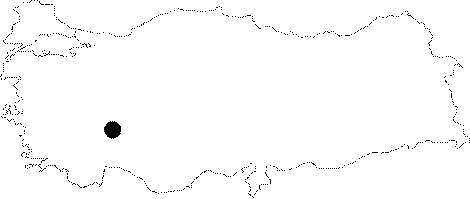
| It is a dry cave. It is located on the northern slope of the Kocyatagi Hill; 3 km southeast of the Dedecam Village. It was developed vertically within the Jura aged dolomithic limestones in accordance with distribution of the layers. It is very rich in dripstones. The bottom is filled with debris and dirt. It is pretty hard to walk inside the cave because of the roof height which is only 1.5 m. It was explored and mapped by MTA. |
| Location: |
| Structural Properties and formation : |
| Research History: |
| Findings: |