|
|
||||
|
|
||||
|
Aksigin |
||||
|
For cave maps and drawings please click on the picture... |
For photographs please click on the photo... |
|||
|
 |
|||
|
Type: |
Vertical Cave | |||
|
Altitude: |
m | |||
|
Depth: |
-51 m | |||
|
Length: |
m | |||
|
Region: |
Marmara | |||
|
Province: |
Kocaeli | |||
|
District: |
Izmit | |||
|
Village: |
Aksigin | |||
|
|
||||
 |
||||
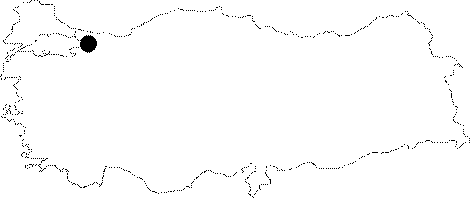
| It is a vertical cave found upon a notification during the explorations of the Yuvacik region in 2001 by BUMAK. It is located in the Aksigin Village. It ends up; getting narrower at -51 m following two descents. It is likely that it is connected with an active system underneath. According to the local people; the hay that they store during rainy periods resurges at the Köprü cave; which is about 400 -500 m away. |
| Location: |
| Structural Properties and formation : |
| Research History: |
| Findings: |