|
|
||||
|
|
||||
|
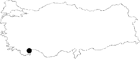
Asarönü |
||||
|
For cave maps and drawings please click on the picture... |
For photographs please click on the photo... |
|||
|
 |
|||
|
Type: |
Horizontal Cave | |||
|
Altitude: |
770 m | |||
|
Depth: |
-5.5 m | |||
|
Length: |
19 m | |||
|
Region: |
Mediterranean | |||
|
Province: |
Antalya | |||
|
District: |
Finike | |||
|
Village: |
Asarönü | |||
|
|
||||
 |
||||
| It was found during the construction of a forest road running up to the summit of the Gülmez Mountain from the Asarönü Village. It was formed within the Upper Cretaceous limestones surfacing on the eastern slopes of the Gülmez Mountain. The bottom and northern side walls are adorned with driptone decorations. It is a dry cave. It was explored and mapped by MTA. |
| Location: |
| Structural Properties and formation : |
| Research History: |
| Findings: |