|
|
||||
|
|
||||
|
At Vadi 3 |
||||
|
For cave maps and drawings please click on the picture... |
For photographs please click on the photo... |
|||
|
 |
|||
|
Type: |
Cave | |||
|
Altitude: |
m | |||
|
Depth: |
-27 m | |||
|
Length: |
443 m | |||
|
Region: |
Aegean | |||
|
Province: |
Manisa | |||
|
District: |
Merkez | |||
|
Village: |
||||
|
|
||||
 |
||||
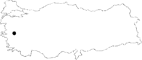
| It is located in the Atlar Valley on the Spil Mountain in Manisa. The researchers had to terminate the exploration at 443 m; but it is estimated that it has a potential length of 914 meters and a depth of -91 meters. It was explored by cavers from the USA. |
| Location: |
| Structural Properties and formation : The entrance to cave was a narrow slot four feet wide and seven feet tall. Two feet of that height was filled with water flowing from the cave. About 50 feet inside we came upon a small dome along the right wall of the entrance passage. This dome measured 20 feet in height. Team discovered a passage 15 feet from the floor and climbed up to explore it. The only trouble encountered in the climb was the cold water trickling over the passage's ledge. The passage went on for about 50 feet before becoming too narrow to enter. Survey measurements were taken and recorded. In the first passage after a movement of 20 feet upstream there is another passage which lay above a three-foot-high waterfall. This short passage led to another small dome with proportions similar to the first one. A pool of water covered the entire floor of the dome. Another passage lies above a ten foot waterfall. Unfortunately, the passage measured and recorded become too low after only 23 feet. The main passage height averaged about 15 feet. Water depth remained at about two feet. High water marks along the passage walls indicated that at some times the water in this tunnel reached depths of over ten feet. After three-foot-high waterfall there is a junction of three passages. The main passage continued to our left. Two smaller passages entered from the right. One of these led to a small dome with an upper level passage 15 feet above the main cave floor. it was checked and measured. But after a few tens of feet it becomes narrow to pass. The other passage was a narrow canyon-like structure that led to a circular-shaped dome. This dome had a height of 25 feet. Pieces of breakdown covered part of the dome's floor. Water flowed slowly from a passage 15 feet above the floor. This passage was entered and found to be another wet hands-and-knees crawl. The passage went for 50 feet before any noticeable increase in ceiling height occurred, this was in a small room that was partially filled by small stalactites. Beyond this room the passage lowered back to a crawl and continued for only a few more feet before becoming too small to enter. Other than three rimstone dams found in the first left-hand side passage, the small stalactites in the upper level were the first speleothems we found in the cave. On a right-hand curve in the main passage, clay banks held the water within their boundaries. Small stalactites and stalagmites were seen along both walls. In less than 70 feet there is another junction area. A sizable passage entered from the right. Following this passage over there is several one-foot-high rimstone dams for several tens of feet before being stopped by a breakdown blockade. The blockage filled the entire space of the passage, allowing only the water to pass. Back in the junction area, there is a large passage to the left. This one led to a large dome that reached upward nearly 80 feet. Since plenty of water flowing at 50 feet above the large passage makes a deep pool in the dome area, no attempts were made to explore the upper levels. Downward to the main passage, water depths were down to only about one foot and the passage's ceiling remained 35 feet high. Approximately 72 feet beyond the last junction area there is another waterfall. Here the ceiling of the passage lowered to about 20 feet. The upper level passage lies in 40 feet beyond the waterfall. This passage was 15 feet up on the walls of the lower passage. The upper passage on the right made a short loop before reconnecting with the lower passage at another intersection point about 50 feet upstream. The upper passage to the left was measured for 130 feet before it became too low to enter. Ceiling heights averaged three feet throughout the upper passage. There is a five-foot-high waterfall to be traversed in order to continue to the point where the two passages made their second connection. The upper passage continued beyond the intersection so. This section of passage was found to end 46 feet. The upper level passage must have been the old cave passage, which, with down-cutting of the stream, has become abandoned. After the third intersection, previously mentioned, in a passage lowered to six feet high the water in the stream remained one foot deep. There are three more waterfalls on a route to another passage on left. The sounds of waterfalls could be heard from both the left-hand passage and the main passage. The left-hand passage led to a sizable dome. Water in the area measured four feet deep. The ceiling of the dome loomed an estimated 90 feet. From 70 feet up, water flowed from a large upper level passage. As before, the upper passage would not have to be explored. The main passage ended shortly after the junction of the left-hand passage we had just exited. The two large domes reached up to the 90 foot mark. Both had passages with water flowing from them about 70 feet above our heads. Team called this part of the cave the Triple Domes area. Searches of the mountain's surface may lead to discoveries of upper entrances to this system. The cave definitely has the potential for exceeding the 3,000-foot mark, and an increase in elevation of over 300 feet. |
| Research History: |
| Findings: |