|
|
||||
|
|
||||
|
Baridini |
||||
|
For cave maps and drawings please click on the picture... |
For photographs please click on the photo... |
|||
|
 |
|||
|
Type: |
Cave | |||
|
Altitude: |
700 m | |||
|
Depth: |
m | |||
|
Length: |
35 m | |||
|
Region: |
Mediterranean | |||
|
Province: |
Isparta | |||
|
District: |
Sütçüler | |||
|
Village: |
Çukurca | |||
|
|
||||
 |
||||
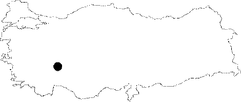
| It lies on the left slope of the valley opened into limestones by the Köprücay River; flowing west of Cukurca. It is an inactive cave; which was formed within the Jura Cretaceous limestones. It is the former discharge mouth of the karstic underground waters in the region. |
| Location: |
| Structural Properties and formation : |
| Research History: |
| Findings: |