|
|
||||
|
|
||||
|
Büyük Obruk |
||||
|
For cave maps and drawings please click on the picture... |
For photographs please click on the photo... |
|||
|
 |
|||
|
Type: |
Vertical Cave | |||
|
Altitude: |
1140 m | |||
|
Depth: |
-58 m | |||
|
Length: |
m | |||
|
Region: |
Central Anatolia | |||
|
Province: |
Konya | |||
|
District: |
Güneysinir | |||
|
Village: |
||||
|
|
||||
 |
||||
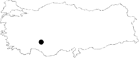
| It lies on a hill with an altitude of 1140 m; 3 km north of Güneysinir. It consists of a 50 m long; 1.40 m wide east-west directed joint. It was explored and mapped to the BCRA 3c standards by MAD in 1995. |
| Location: |
| Structural Properties and formation : |
| Research History: |
| Findings: |