|
|
||||
|
|
||||
|
Çatal Obruk |
||||
|
For cave maps and drawings please click on the picture... |
For photographs please click on the photo... |
|||
|
 |
|||
|
Type: |
Vertical Cave | |||
|
Altitude: |
2450 m | |||
|
Depth: |
-245 m | |||
|
Length: |
m | |||
|
Region: |
Mediterranean | |||
|
Province: |
Mersin | |||
|
District: |
Arslanköy | |||
|
Village: |
||||
|
|
||||
 |
||||
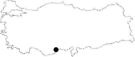
| Location: It is located at the Alacayir Mevkii on the Bolkar Mountain. |
| Structural Properties and formation : The region is entirely made of the Miocene aged richly fractured and jointed limestones. Consisting of two vertical chimneys; it was formed within the base of a solution doline. It is a fossil cave; which completely developed vertically. |
| Research History: It was explored by the Cave Research Club of the Dokuz Eylül University in 1996 during the surveys called "Yörük". |
| Findings: The most common fossils in the region are Gastropods and Shells. |