|
|
||||
|
|
||||
|
Degirmen |
||||
|
For cave maps and drawings please click on the picture... |
For photographs please click on the photo... |
|||
|
 |
|||
|
Type: |
Horizontal Cave | |||
|
Altitude: |
1300 m | |||
|
Depth: |
m | |||
|
Length: |
662 m | |||
|
Region: |
Black Sea | |||
|
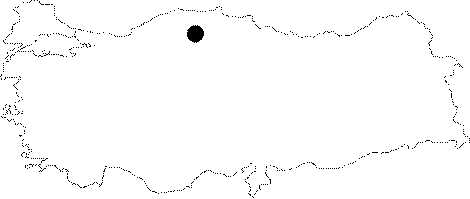
Province: |
Kastamonu | |||
|
District: |
Devrekani | |||
|
Village: |
Sarpunalinca | |||
|
|
||||
 |
||||
| Location: |
| Structural Properties and formation : It drains the waters collected in the Sarpunalunca region. With a length of 662 m; it drains like a spring through a small 3.5 m siphon at the exit. It is completely horizontal and active. The waters flow through the rocky blocks along a joint. It is not rich in cave decorations. |
| Research History: It was explored and mapped by BUMAK in 1981. |
| Findings: |