|
|
||||
|
|
||||
|
Degirmenkaya |
||||
|
For cave maps and drawings please click on the picture... |
For photographs please click on the photo... |
|||
|
 |
|||
|
Type: |
Vertical Cave | |||
|
Altitude: |
620 m | |||
|
Depth: |
-18 m | |||
|
Length: |
40 m | |||
|
Region: |
Marmara | |||
|
Province: |
Bursa | |||
|
District: |
Iznik | |||
|
Village: |
Derbent | |||
|
|
||||
 |
||||
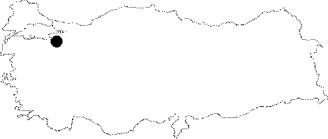
| It is located on a rocky area next to the Mecidiye-Kizilhisar road which deviates to left before the Derbent Village at 9th km of the Iznik-Yenisehir motorway. It was formed like a shaft within the Permian marble block. It drops into a -13 m shaft. Located on the vadose zone; it is entirely dry except the waters leaking during rainy seasons. It was explored and mapped by MTA; and published in 1997. |
| Location: |
| Structural Properties and formation : |
| Research History: |
| Findings: |