|
|
||||
|
|
||||
|
Deri Obrugu |
||||
|
For cave maps and drawings please click on the picture... |
For photographs please click on the photo... |
|||
|
 |
|||
|
Type: |
Cave | |||
|
Altitude: |
m | |||
|
Depth: |
-32 m | |||
|
Length: |
40 m | |||
|
Region: |
Mediterranean | |||
|
Province: |
Mersin | |||
|
District: |
Erdemli | |||
|
Village: |
Uzundere | |||
|
|
||||
 |
||||
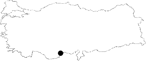
| It is located at Musabozuldu Mevkii. It was formed within the Miocene limestones. It is very poor in decorations. It lies 3 km northwest of the Kel Pothole at Musabozuldu Mevkii of Uzundere. It was explored by the Izmir Cavers Union in 1996; and mapped to the 3c standards. |
| Location: |
| Structural Properties and formation : |
| Research History: |
| Findings: |