|
|
||||
|
|
||||
|
Düden |
||||
|
For cave maps and drawings please click on the picture... |
For photographs please click on the photo... |
|||
|
 |
|||
|
Type: |
Cave | |||
|
Altitude: |
m | |||
|
Depth: |
m | |||
|
Length: |
m | |||
|
Region: |
Mediterranean | |||
|
Province: |
Antalya | |||
|
District: |
Manavgat | |||
|
Village: |
Tilkiler | |||
|
|
||||
 |
||||
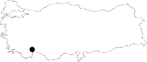
| Location: It is located at the bank of the Düden Creek on the road leading to the Tilkiler Village; where Oymapinar Dam is situated [Aygen 1986:25-26]. It is 1 km far from the village of Homa. |
| Structural Properties and formation : It can be descended down to 65 m. Housing two small underground lakes; it functions as both recipient and drainer of water. This sinkhole; scientifically called "summer spring"; has a scientific significance [Aygen 1986:25-26]. It can be reached by climbing through 3 m high rocky blocks and a rocky wall. It continues its activation as being dry in summer and fall; as a ponor in winter; and as a sinkhole; which drains the water to the Homa Village in spring [Oldham 1974:77]. |
| Research History: It was explored by T. Aygen and his team during the preliminary studies for the Oymapinar Dam. |
| Findings: Black colored big scorpions were seen among the collapse material [Basar 1977:46] |