|
|
||||
|
|
||||
|
Gürcüoluk |
||||
|
For cave maps and drawings please click on the picture... |
For photographs please click on the photo... |
|||
|
 |
|||
|
Type: |
Cave | |||
|
Altitude: |
350 m | |||
|
Depth: |
+14 m | |||
|
Length: |
169 m | |||
|
Region: |
Black Sea | |||
|
Province: |
Bartin | |||
|
District: |
Amasra | |||
|
Village: |
Karakaçak | |||
|
|
||||
 |
||||
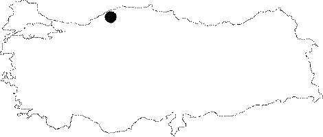
| Location: It is located in the Ovacik Quarter of the Karakacak Village of Amasya; 32 km far from Bartin. Following the road turning to south at the Cakraz-Bozköy Junction; and then passing through the Konuklar Quarter of the Karakacak Village; a 3-4 km walk is required; sometimes inside the forest; sometimes in pathways toward the south over the Ovacik Quarter. |
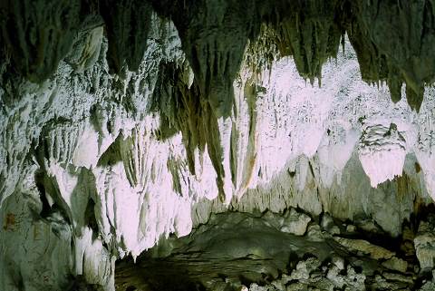
| Structural Properties and formation : Following a triangle-shaped main entrance; it consists of nearly 15 to 20 rooms surrounding a 2-3 m high; 3-4 m wide and 4-5 m long inclining intermediate room. The first room; almost 6x7 m; is filled with stalactites and stalagmites. Similarly; big and little rooms elongating in the east; north and northeast directions are adorned with stalactites and stalagmites. The upper rooms are accessible through one of them whereas through another; a corridor which is barely wide enough for one person to pass leads to the ground. The temperature is very low in the cave. Difficulty experienced in breathing while exploring the cave results from the excessive amount of carbon dioxide; therefore it is considered that it can be an attraction particularly for asthma patients. |
| Research History: No comprehensive scientific survey has been carried out yet. |
| Findings: |