|
|
||||
|
|
||||
|
Gürleyik 1 |
||||
|
For cave maps and drawings please click on the picture... |
For photographs please click on the photo... |
|||
|
 |
|||
|
Type: |
Horizontal Cave | |||
|
Altitude: |
1050 m | |||
|
Depth: |
+2 m | |||
|
Length: |
77 m | |||
|
Region: |
Central Anatolia | |||
|
Province: |
Eskisehir | |||
|
District: |
Mihaliçcik | |||
|
Village: |
Gürleyik | |||
|
|
||||
 |
||||
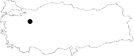
| Location: It is located on the right bank of the Kayalibogaz Creek; 2 km south of the Mihaliccik District. It can be reached from the Mihaliccik-Nallihan road. A 45-minute walk leads to the cave from the town of Dinek. |
| Structural Properties and formation : Halted its development; it is an abandoned fossil cave. It is adorned with many decorations (stalactites; stalagmites; columns and drapery dripstones and helictites). |
| Research History: It was explored by MTA; and its map and other characteristics were published in 2001. |
| Findings: A restricted number of bats inhabits the entrance hall and several parts of the main gallery. |