|
|
||||
|
|
||||
|
Hanarkasi Ini 1 |
||||
|
For cave maps and drawings please click on the picture... |
For photographs please click on the photo... |
|||
|
 |
|||
|
Type: |
Cave | |||
|
Altitude: |
1508 m | |||
|
Depth: |
-1 m | |||
|
Length: |
53 m | |||
|
Region: |
Central Anatolia | |||
|
Province: |
Karaman | |||
|
District: |
Merkez | |||
|
Village: |
Lale | |||
|
|
||||
 |
||||
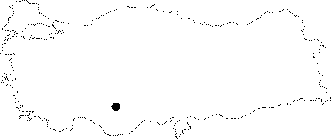
| It is located in the Lale Village of Karaman Province Center. It is a stream type; fossil cave which had horizontally developed inside the Middle Miocene aged limestones. Its basin is covered by a thick layer of soil; and debris. It was researched by the Geological Studies Department of MTA General Directorate; and published in 2005. |
| Location: |
| Structural Properties and formation : |
| Research History: |
| Findings: |