|
|
||||
|
|
||||
|
Inlik Düdeni |
||||
|
For cave maps and drawings please click on the picture... |
For photographs please click on the photo... |
|||
|
 |
|||
|
Type: |
Vertical Cave | |||
|
Altitude: |
1650 m | |||
|
Depth: |
-115 m | |||
|
Length: |
m | |||
|
Region: |
Central Anatolia | |||
|
Province: |
Nigde | |||
|
District: |
Ulukisla | |||
|
Village: |
Madenköy | |||
|
|
||||
 |
||||
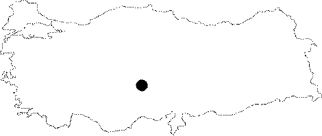
| Location: It lies on the Alacam Plateau where the people of Bademler and Pinarbasi villages live during summer at Aladag. It is 1650 m high; located on the southwestern slope of a small hill called Usakpinari. |
| Structural Properties and formation : It ends up with a 90 m descent following two short subsequent descents. |
| Research History: It was explored by MAD in 1990; and mapped to the BCRA 3c standard. |
| Findings: |