|
|
||||
|
|
||||
|
Karasu |
||||
|
For cave maps and drawings please click on the picture... |
For photographs please click on the photo... |
|||
|
 |
|||
|
Type: |
Cave | |||
|
Altitude: |
20 m | |||
|
Depth: |
0 m | |||
|
Length: |
20 m | |||
|
Region: |
Marmara | |||
|
Province: |
Sakarya | |||
|
District: |
Karasu | |||
|
Village: |
Merkez | |||
|
|
||||
 |
||||
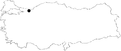
| Location: Karasu Cave which is located 2 km west from Karasu District in Sakarya Province; is between the dune and the rocks just east of the channel where the Sakarya River delta starts. |
| Structural Properties and formation : It is between the bedrock and the Sakarya River alluvium. It was developed inside the Upper Cretase-Lower Eocene aged limestones; spreading to a large area in the region. It had expanded horizontally in NE-SW direction; it is a sinkhole type; active cave. Its total length is 20 m; and it is 1-3 m wide; 1-2 m high. It bears a subsurface stream and a small pond. Its final point is at the same level with its entrance. |
| Research History: It was researched by the Geological Studies Department of MTA General Directorate; and published in 2002. |
| Findings: |