|
|
||||
|
|
||||
|
Kocain |
||||
|
For cave maps and drawings please click on the picture... |
For photographs please click on the photo... |
|||
|
 |
|||
|
Type: |
Vertical Cave | |||
|
Altitude: |
m | |||
|
Depth: |
-54 m | |||
|
Length: |
m | |||
|
Region: |
Aegean | |||
|
Province: |
Mugla | |||
|
District: |
Yatagan | |||
|
Village: |
Kavak | |||
|
|
||||
 |
||||
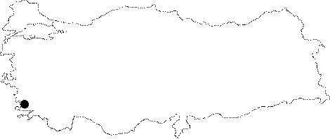
| It is located on the skirt of the Keneltepe on the right side of the road running to Yatagan from the Kavak Village. It can be reached by climbing toward Keneltepe next to a cistern located on the right side of the road. It is difficult to find it without guidance as it is just a 1x1 m hole. It was explored and mapped to the 2c standards by BUMAK in 1987. |
| Location: |
| Structural Properties and formation : |
| Research History: |
| Findings: |