|
|
||||
|
|
||||
|
Memeli In |
||||
|
For cave maps and drawings please click on the picture... |
For photographs please click on the photo... |
|||
|
 |
|||
|
Type: |
Cave | |||
|
Altitude: |
150 m | |||
|
Depth: |
+4.5 m | |||
|
Length: |
22 m | |||
|
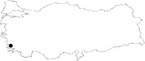
Region: |
Mediterranean | |||
|
Province: |
Mugla | |||
|
District: |
Fethiye | |||
|
Village: |
Göcek | |||
|
|
||||
 |
||||
| Location: It is hard to access from the land. It can be reached by walking and passing over a mountainous area after driving a while through the road running from Dalaman to the quay of Sarsala. It is also possible to reach to the bay after a one-hour boat trip from Göcek. It takes about 45 minutes to climb a steep slope with maquis. It is difficult to find without guidance. |
| Structural Properties and formation : It was formed within the Dolomitic limestones containing hornstein within the border of a series with marl. It is dry; therefore it halted its development as it is very high from the sea level. |
| Research History: It was explored by MTA in 1984. |
| Findings: |