|
|
||||
|
|
||||
|
Soguksu |
||||
|
For cave maps and drawings please click on the picture... |
For photographs please click on the photo... |
|||
|
 |
|||
|
Type: |
Cave | |||
|
Altitude: |
61 m | |||
|
Depth: |
-7.5 m | |||
|
Length: |
262 m | |||
|
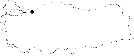
Region: |
Marmara | |||
|
Province: |
Sakarya | |||
|
District: |
Kocaali | |||
|
Village: |
Yenimahalle | |||
|
|
||||
 |
||||
| Location: It is located in the upper section of Acitarla Stream near Yenimahalle which is 2 km southwest of Kocaali District at the Black Sea shore; approximately 50 km northeast of Adapazari. The subsurface stream inside the cave is one of the sources that creates this stream. The cave is accessed by the road from Kocaali to Kirazli Village. This road is very close to the cave. |
| Structural Properties and formation : Soguksu Cave which is in a very close location to the sea; cracked by the Maden (Karasu) Stream and the Melen Brook; and their stream; is a cave that shows the characteristics of a multi-period development. It is situated at the basin of a uvala cracked by the Acutarla Stream. The cave had developed in NE-SW direction; consisting of two branches. The first section of the cave is the fossil part that extends in NE direction. The fossil gallery which is 2-4 m wide and 1-4 m high has a basin covered with soil; sand; pebbles; and debris. The last section of the gallery which is at -4m from the entrance bears a closed siphon at the end. The fossil gallery connects with a half active gallery through a right angle turn. The connection gallery that develops in NW direction has a siphon in its center at -7.5 m according to the 35 m long entrance. The subsurface stream in the cave leaves the cave through this siphon. The connection gallery makes a second elbow turn in SW direction to connect with the half active section. This twisted canyon or meander canyon shaped section extending in NE-SW direction is narrower. The half active gallery bearing a subsurface stream with a continuous flow; has a basin filled with pebbles; sand; and debris pile-up. The subsurface stream comes from a siphon at -4.5 m. The siphon which opens into a gallery; expands in the NW direction just as in the Connection Gallery in the first section. The cave had developed in different periods and location; consisting of two connecting sections. The fossil part where the entrance is at; is the gallery that was primarily formed at the source location. As a result of the cracking of the region deeply by the rivers; and the suspension of the uvala on which the cave sits; this section took over the sinkhole position; and connected with the half active section. The position of the passage type; half active gallery has not changed; and it completely deepened. Those two sections which developed independently in the beginning in NE-SW direction; were connected through an elbow type connection gallery which developed in the main crack direction; after being flooded or splitted by the rivers. As a result of this the cave bore a grill type structure. The cave development currently is in the part where the the siphon is located at; and in the same direction. On the other hand the siphon at the end of the Fossil Section expands as a new connection gallery. The entrance mouth of the Soguksu cave which does not bear any dripstone formations; has three siphons including one source and two sinkholes. |
| Research History: It was researched by the Geological Studies Department of the MTA General Directorate and published in 2002. |
| Findings: A few amount of bats live in the fossil section of the Soguksu Cave which consists of dry and wet sections. |