|
|
||||
|
|
||||
|
Yazkonagi 1 |
||||
|
For cave maps and drawings please click on the picture... |
For photographs please click on the photo... |
|||
|
 |
|||
|
Type: |
Cave | |||
|
Altitude: |
85 m | |||
|
Depth: |
+12 m | |||
|
Length: |
900 m | |||
|
Region: |
Black Sea | |||
|
Province: |
Ordu | |||
|
District: |
Ünye | |||
|
Village: |
Yazkonagi | |||
|
|
||||
 |
||||
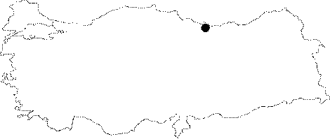
| Location: Along with Yazkonagi 2 cave it is located on the western bank of Saydere (Lahana stream); just south of Ünye (Karagöl quarter) in the province of Ordu. The distance between the two caves is approximately between 150 - 200 m. |
| Structural Properties and formation : The cave developed in east to west direction on a clear faultline. Yazkonagi 1 and 2 consist the parts of the same underground system and they were developed in the east-west direction unlike the flow direction of the present rivers which is from south to north. Yazkonagi 1 entrance altitude is 85 m; and it is 30 m above the valley basin. The cave consists of two sections; the main gallery extends first in the south direction; then towards the west; it is narrow but high depending on a clearcut fault. This section's width gets as narrow as 1 m in some parts; and the ceiling heighr reaches 25-30 m. The basin is filled with blocks; pebbles; and sand pile-ups. The main gallery represents two different development phases. There are two 25 m high waterfalls; one is in the middle; and the other is in the end. This section extends completely horizontally; and its endpoint is at +6.5 m from the entrance; and it is poor in dripstone formations. The second section which splits towards the north (right) from the entrance; contains extremely beautiful dripstone formations (such as curtains; ponds; stalactites; stalagmites; columns). This branch is 160 m long; and has ups; and downs in various heights; and its last section is at -2m from the entrance. Although the subsurface stream that flows in the main gallery is coming out of the entrance mouth of the cave the subsurface stream at the branch disappears at a point near the center at - 12 m from the entrance. These waters appear again inside the Yazkonagi 2. Yazkonagi 1 which bears the forms and shapes; that show the characteristics of a multi-period development cycle; is an active cave that continues its development. It is assumed that there is another cave storey above this cave. The water falling from 25 m of height by making waterfalls; and the large galleries observed in the narrow cracks of the cave ceiling suggest its presence. |
| Research History: It was researched by the Karst and Cave Researches Unit of the Geological Studies Department; of MTA General Directorate; and published in 2004. |
| Findings: There are a few bats inside the cave. |