|
|
||||
|
|
||||
|
Yerlekaya |
||||
|
For cave maps and drawings please click on the picture... |
For photographs please click on the photo... |
|||
|
 |
|||
|
Type: |
Cave | |||
|
Altitude: |
m | |||
|
Depth: |
-99 m | |||
|
Length: |
m | |||
|
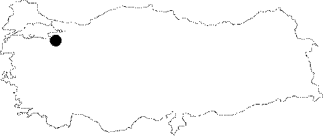
Region: |
Marmara | |||
|
Province: |
Bursa | |||
|
District: |
Keles | |||
|
Village: |
Gelemiç | |||
|
|
||||
 |
||||
| It is very close to the Gelemic Village; but it is not easily accessible. It lies right above Sarikaya; situated on a slope visible from the village. After passing through the village; and descending to the valley; a left is made; and then from that point where two creeks meet; the hill is climbed. Where a steep scree ends lies the cave to the left of a big rock. The mouth of the cave is small and it faces the opposite slope. There is no water inflow; but it is very muddy. It consists of an inclining gallery; and no remarkable decorations were seen. |
| Location: |
| Structural Properties and formation : |
| Research History: |
| Findings: |