|
|
||||
|
|
||||
|
Ardiçsuyu 1 |
||||
|
For cave maps and drawings please click on the picture... |
For photographs please click on the photo... |
|||
|
 |
|||
|
Type: |
Cave | |||
|
Altitude: |
m | |||
|
Depth: |
-1 +2.4 m | |||
|
Length: |
412 m | |||
|
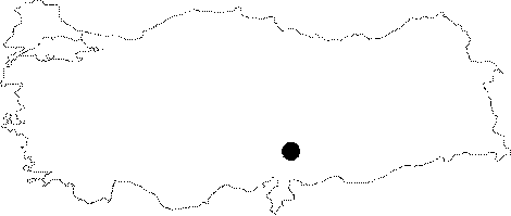
Region: |
Mediterranean | |||
|
Province: |
Kahramanmaras | |||
|
District: |
Merkez | |||
|
Village: |
Tekir | |||
|
|
||||
 |
||||
| It is situated inside the recreational zone 3 km from Tekir Sub-district. The cave was composed inside the Middle-Upper Miocene Age limestones consisting of yellowish grey channel cobbles and the mixture of cobbles with sandstones which is highly permeable. It lies in NE-SW direction and was cut through a crack in the opposite northwest-southeast direction, it is accessible through two ends. The cave is approximately 10 m over the stream level and lies horizontally and it is hydrologically entirely fossilized. Ardiçsuyu Cave makes curves along its main course, its floor was covered with clay and contains some dripstone formations. The ceiling height reaches 1.5-2 m at some locations. The are many gallery passages in the cave and cave sediments are observed. It was explored and mapped by MTA in 2008. A few centipedes were observed. |
| Location: |
| Structural Properties and formation : |
| Research History: |
| Findings: |