|
|
||||
|
|
||||
|
Küp Magarasi |
||||
|
For cave maps and drawings please click on the picture... |
For photographs please click on the photo... |
|||
|
 |
|||
|
Type: |
Horizontal Cave | |||
|
Altitude: |
m | |||
|
Depth: |
-30 m | |||
|
Length: |
127 m | |||
|
Region: |
Central Anatolia | |||
|
Province: |
Eskisehir | |||
|
District: |
Seyitgazi | |||
|
Village: |
Dogançayir | |||
|
|
||||
 |
||||
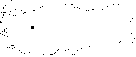
| It lies in the northwest slope of Mount Kirkkiz in the southeast of Dogancayir Couty. It is a fossil cave developed along the fault elongating to direction of north-south with a degree of -35. There are few cyrstal formations at the end part of the cave. It was mapped and reseached by KMG in 2011. |
| Location: |
| Structural Properties and formation : |
| Research History: |
| Findings: |