|
|
||||
|
|
||||
|
Tekkeköy - Findicak |
||||
|
For cave maps and drawings please click on the picture... |
For photographs please click on the photo... |
|||
|
 |
|||
|
Type: |
Rock Shelter | |||
|
Altitude: |
55 m | |||
|
Depth: |
m | |||
|
Length: |
m | |||
|
Region: |
Black Sea | |||
|
Province: |
Samsun | |||
|
District: |
Merkez | |||
|
Village: |
Tekkeköy | |||
|
|
||||
 |
||||

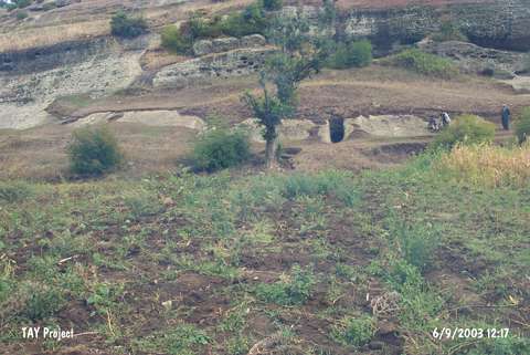
| It is located in a valley watered by the Findicak and Cinarlik Creeks originating from the Ayitepesi and Karabücük Mountains to the south of Tekkeköy; a western extension of the Carsamba Plateau; approximately 14 km southeast of Samsun. To the southwest flows a branch of the Findicak River. Tekeköy (or Tekkeköy); which at present almost has become one of the quarters of Samsun; has been spreading partly on slopes of the hills on both sides of the valley; and partly on the coastal plain. There lie big massive rocks formed by corrosion in the valley to the immediate south of the village where the southern mountains are covered by woods as well as presently arable fields on the ridges. There are fresh water sources nearby. The Samsun-Carsamba railroad and motorway pass underneath the mouth of the valley facing the Black Sea. It is possible to see the rock shelters and caves on the slopes of the valley opening to the coastal plain. The explorations revealed the presence of 2 caves; 30 small and 6 big rock shelters. It was found an excavated by T. Ozgüc and K. Kökten in 1940. It is also known as Tekeköy - Findicak. |
| Location: This rock-shelter is located approximately 14 km southeast of the city of Samsun; south of the village of Tekeköy; which is west of the Çarsamba Plain. The site lies in the valley at the confluence of the Findincak and Çinarlik streams; which spring from Mount Ayitepesi and Karabücük. The site lies partially on the plain and partially on the flanks of the hills on both sides of the valley in the village of Tekkeköy (or Tekeköy); now a district of the Samsun city. |
| Structural Properties and formation : |
| Research History: |
| Findings: |