|
©The Archaeological Settlements of Turkey - TAY Project
|
|
|
|
|
Ahmetli Kalesi |
|
|
|
|
|
For site maps and drawings please click on the picture...  |
For photographs please click on the photo... 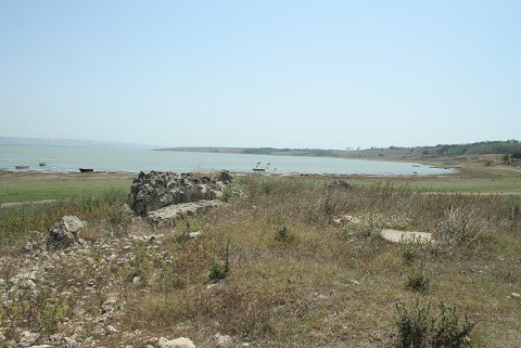 |
|
|
|
|
Type:
|
Fortification |
|
Plan Type:
|
|
|
Year of Costruction:
|
|
|
Phase:
|
|
|
Investigation Method:
|
Survey |
|
Altitude:
|
0 |
|
|
|
|
Region:
|
Marmara |
|
Province:
|
Istanbul |
|
District:
|
Çatalca |
|
Village:
|
Ahmetli |
|
Antique Name:
|
Athyra |
|
|
|
 |
|
| The fortress remains on the west shores of Büyükçekmece Lake was researched by M.H. Sayar who was performing surveys in the region in 1996. The southeast corner of the rectangular planned fortress is under the waters of the lake. It was hypotized that the fortress was built in order to defend the fructuous plantations in the region as part of a military master plan [Sayar 1997:110, res. 3; Sayar 2001:291]. It is located near the Ahmetli Village on the west bank of the Büyükçekmece Lake, 10 km to the north of Athyra (Büyükçekmece), which was a significant stop on the ancient road which interconnected Istanbul to the west. The wall remains in southwest direction descends down to the lake shores. The fortifications were mostly collapsed, only parts remained. The southwest section contains two bastions. It is probable that the fortress gate was located at that part. There are fortification remains to the northeast. That fortification continues in the direction of northwest and inside the lake. Some of the walls either remained underneath the ground or demolished. Three wall remains can be observed at foundation level. The wall masonry consists of mortared rubble stones. A room inside the fortress at the center can be observed at foundation level. Besides these this area contains an architrave and a column pedestal [TAYEx 18.08.2008]. |
| Location: |
| Geography and Environment: |
| Research and Excavation: |
| Description: |
| Finds: |
| Interpretation: |
| Destruction: One of the bastions in the southwest section is being used as a public bathroom, the other was transformed into a doghouse. The northeast fortification was filled with garbage, debris and soil [TAYEx 18.08.2008]. |