|
©The Archaeological Settlements of Turkey - TAY Project
|
|
|
|
|
|
Gavurevleri |
|
|
For site maps and drawings please click on the picture...  |
For photographs please click on the photo... 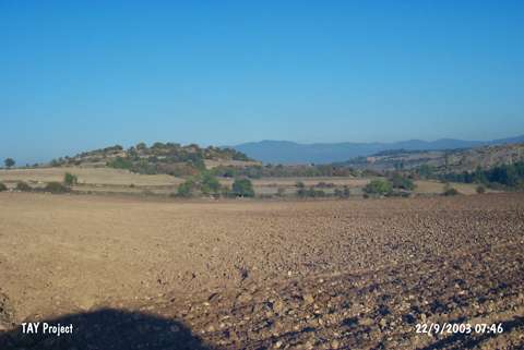 |
|
Type:
|
Mound |
|
Altitude:
|
750 m |
|
Region:
|
Black Sea |
|
Province:
|
Kastamonu |
|
District:
|
Daday |
|
Village:
|
Yazicimeydani |
|
Investigation Method:
|
Survey |
|
Period:
|
|
|
|
|
 |
|
| It lies to the south of Daday River; on a slope inclining towards the Kincilar Stream; 100 m north of Yazicimeydani (Meydankoy) Village; southeast of Daday District of Kastamonu Province. It was discovered in 1997 during the Kastamonu Survey conducted by A. Özdogan; C. Marro and A. Tibet. It measures 15 m in height and 250 m in diameter. Remains of mudbrick walls were uncovered in a illicitly digged pit at 3 m depth and 2x3 m width. Red burnished and washed EBA pottery was recovered as well as materials of the second millennium BC; the Phrygian; Hellenistic and Roman Periods. The site had been settled on the terrace of a natural rocky block which is 20-25 m high above the stream. It is coded under C 31 - 16. |
| Location: |
| Geography and Environment: |
| History: |
| Research and Excavation: |
| Stratigraphy: |
| Small Finds: |
| Remains: |
| Interpretation and Dating: |