|
©The Archaeological Settlements of Turkey - TAY Project
|
|
|
|
|
|
Girik Tepe |
|
|
For site maps and drawings please click on the picture...  |
For photographs please click on the photo... 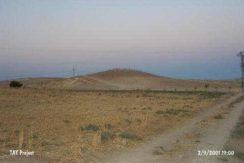 |
|
Type:
|
Mound |
|
Altitude:
|
570 m |
|
Region:
|
Southeastern Anatolia |
|
Province:
|
Adiyaman |
|
District:
|
Merkez |
|
Village:
|
Bebek |
|
Investigation Method:
|
Survey |
|
Period:
|
Early |
|
|
|
 |
|
| The mound lies south-southwest of Adiyaman; 7.8 km south of Akpinar; 1.5 km northeast of Turus village. It is one of the Neolithic Age sites of the region. R.S. Blaylock; D.H. French and G.D. Summers from the Tille excavation team discovered and surveyed the site numbered 102 in 1985-88. Three Halaf painted sherds of good quality were collected. In addition; two silex arrow/spear heads were found. It was visited during the survey conducted by S. Ezer and his team in 2015 [Ezer et al. 2017:470] |
| Location: This site lies south of the city of Adiyaman; 7.6 km south of the town of Akpinar and 3.3 km southwest of the village of Bebek. |
| Geography and Environment: This site is northwest of Mount Karababa in the eastern part of a valley which reaches the Euphrates River Valley. The dimensions of the mound have not been reported. |
| History: |
| Research and Excavation: |
| Stratigraphy: |
| Small Finds: |
| Remains: |
| Interpretation and Dating: |