|
©The Archaeological Settlements of Turkey - TAY Project
|
|
|
|
|
|
Habuhastepe |
|
|
For site maps and drawings please click on the picture...  |
For photographs please click on the photo... 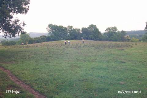 |
|
Type:
|
Mound |
|
Altitude:
|
60 m |
|
Region:
|
Black Sea |
|
Province:
|
Sinop |
|
District:
|
Merkez |
|
Village:
|
Bektasaga |
|
Investigation Method:
|
Survey |
|
Period:
|
|
|
|
|
 |
|
| It lies on the western bank of the Karasu Stream (Erfelek); immediate south of Bektasaga Village; southwest of Sinop Province. It was discovered in 1987 during the Sinop Survey conducted by M.A. Isin. It consists of two hills; one measuring 80 m and the other 60 m in diameters while both measure ca. 3 m in height. Grit; plant and seashell tempered; red colored EBA pottery was collected from the surface. It takes place in the registered archaeological sites list prepared by Ministry of Culture and Tourism. |
| Location: |
| Geography and Environment: |
| History: |
| Research and Excavation: |
| Stratigraphy: |
| Small Finds: |
| Remains: |
| Interpretation and Dating: |