|
©The Archaeological Settlements of Turkey - TAY Project
|
|
|
|
|
|
Alayhan Höyük |
|
|
For site maps and drawings please click on the picture...  |
For photographs please click on the photo... 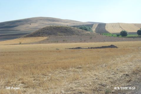 |
|
Type:
|
Mound |
|
Altitude:
|
1205 m |
|
Region:
|
Central Anatolia |
|
Province:
|
Aksaray |
|
District:
|
Merkez |
|
Village:
|
Alayhani |
|
Investigation Method:
|
Survey |
|
Period:
|
|
|
|
|
 |
|
| It lies 1.2 km west of Alayhanı Village; immediate north of the Aksaray-Nevsehir Highway; northeast of Aksaray Province. It is a medium sized mound. It is ca. 15 m high. Out of the pottery recovered during the collaborative survey of the Aksaray; Nevsehir and Nigde Provinces conducted in 1996 by a team under S. Gülçur; the black bright burnished ware akin to the ones found at the Güvercinkaya settlement and the red washed ware (EBA ware according to Gülçur) were collected from the surface. It is reported that there are remains of foundation stones and mudbrick fillings on the surface. It is coded under O 34 / 01. |
| Location: |
| Geography and Environment: |
| History: |
| Research and Excavation: |
| Stratigraphy: |
| Small Finds: |
| Remains: |
| Interpretation and Dating: |