|
©The Archaeological Settlements of Turkey - TAY Project
|
|
|
|
|
|
Çavdarhisar / Aizanoi |
|
|
For site maps and drawings please click on the picture...  |
For photographs please click on the photo... 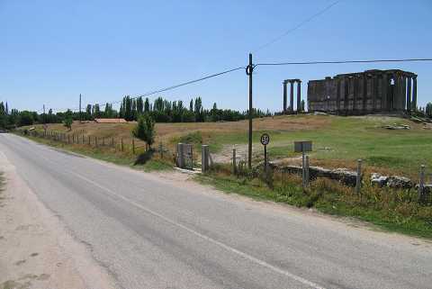 |
|
Type:
|
Mound and City |
|
Altitude:
|
980 m |
|
Region:
|
Aegean |
|
Province:
|
Kütahya |
|
District:
|
Çavdarhisar |
|
Village:
|
Merkez |
|
Investigation Method:
|
Excavation |
|
Period:
|
|
|
|
|
 |
|
| Location: The mound is located within the boundaries of ancient city of Aizanoi 2 km from Çavdarhisar District in Kütahya. It is north-northeast of Çavdarhisar-Emet road. |
| Geography and Environment: The city has been founded on both sides of the Çavdarhisar Stream. Karaçay (Pankalos) Stream flows from the south-southeast of the mound. However the mound where a Zeus Temple erected on the top hill lies in the ancient city; 200 m west of the stream. |
| History: |
| Research and Excavation: |
| Stratigraphy: |
| Small Finds: |
| Remains: |
| Interpretation and Dating: |