|
©The Archaeological Settlements of Turkey - TAY Project
|
|
|
|
|
|
Ulucak Höyük |
|
|
For site maps and drawings please click on the picture...  |
For photographs please click on the photo... 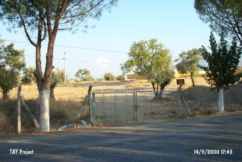 |
|
Type:
|
Mound and Cemetery |
|
Altitude:
|
220 m |
|
Region:
|
Aegean |
|
Province:
|
Izmir |
|
District:
|
Kemalpasa |
|
Village:
|
Ulucak |
|
Investigation Method:
|
Excavation |
|
Period:
|
|
|
|
|
 |
|
| Location: It lies 150 m north of the Bornova-Turgutlu-Ankara motorway at 15th km; 7 km northwest of Kemalpasa; east of the Bornova District and the Izmir Province. It is about 400 km north of the old Izmir-Kemalpasa road and 1 km south of Ulucak village. To the immediate south lies the tobacco factory of Socotap. The cemetery is located 150 m southeast of the mound in the garden of this factory [Derin-Özkan 1999:plan1]. The road parting from the motorway to the village of Ulucak passes by the west side of the hill. The cemetery is partly obscured by the motorway. |
| Geography and Environment: It is a round and flat mound located in a plain; 5 m in height and 90 m in diameter [French 1965b:18]. The settlement is suggested to measure larger. The southern and eastern parts of the hill have been partly damaged by the road and the environmental arrangement factories. The mound gets lower toward the north. The plain of Kemalpasa formed a fertile land around the mound by the accumulation of alluvial brought by the waters running from the high mountains in the vicinity. The plain is separated from the shore plain of Bornova by the threshold of Belkahve. The settlement is reported to be located on the natural transportation road between Central Anatolia and the Gulf. The mound is said to locate at the foothill of an old accumulated conic hill [Derin-Öner 1997:412]. The cemetery has been partly damaged during the construction of the factory. A small stream flows about 400 m south; parallel to the road. It is reported that the site was cultivated at during the researches. Together with the excavations; palaeogeographical investigations including the mound and its surroundings were also started under the leadership of I. Kayan from the Geography Department of Ege University; and it was understood that the mound once expanded over a much larger area. |
| History: |
| Research and Excavation: It was introduced by D.H. French [French 1969:55]. A survey was carried out by R. Meriç [Meriç 1989:387; Meriç 1990:362]. It was excavated from 1995 to 2002 by Z. Derin under the consultation of A. Çilingiroglu. The excavation was taken over by E. Abay; H. Saglamtimur and T. Özkan in the recent years. The palaeogeographical surveys of the settlement and its surrounding territory are carried out in parallel to the excavations. Soil samples were taken by carrot in the vicinity. The cemetery was also started to be excavated in 1998 in parallel to the excavation by the University of Ege and the Izmir Archaeological Museum. The site was revisited and investigated by a team under Z. Derin during the fieldwork of Bornova-Kemalpasa (Izmir) Archaeological Inventory. The mound was dug by a team under the leadership of A. Çilingiroglu in 2005. The excavations are lead by Ö. Çevik from Trakya University since 2009. It takes place in the registered archaeological sites list prepared by Ministry of Culture and Tourism. |
| Stratigraphy: Including the 2005 excavations; the Ulucak Höyük Stratification is as follows: I. Late Roman-Early Byzantine: a; b; c II. Early Bronze Age (II): a; b 1/2 III. Late Chalcolithic IV. Neolithic: a; b 1/2; c; d; e; f; g; h; i; k V. Neolithic a; b [Çilingiroglu-Dedeoglu 2007:142]. 2006 radiocarbon dates for VB phase are 6400/6200 BC, and there is still 4 m of cultural deposit below. Phase Ve belongs to the early 7th millennium. 2007 radiocarbon dates show these levels date back to the 7th millennium BC. Dates for Level 4 are 5990-5730, 6030-5895 and 6055-5885 BC, while Level 5 has dates of 6230-6055, 6430-6240 and 6660- 6450 BC. [http://cat.une.edu.au/page/ulucak%20hoyuk-kemalpasa; 16.11.2009, 15:10]. In previous studies, Level VI was assigned to Early Neolithic and Level V was dated to Late Neolithic. However, the data obtained from recent studies and radiocarbon dates show that it would be more accurate to define Level VI, which yielded no findings including pottery, as Proto Neolithic. In addition, it was suggested that Level V, which is characterized by wattle and daub and piled mudbrick architecture, should be dated to Early Neolithic and Level IV, which is represented by mudbrick architecture, should be assigned to Late Neolithic [Çevik-Vuruskan 2015:583]. |
| Small Finds: Architecture: The data on Early Chalcolithic (5600-5400 BC) was obtained from Trench O13 located on top of the mound. It is seen that this level contains 2 phases. The late phase yielded three pithoi and two pits. In the early phase, a room (Room 49) was exposed. The wall measuring 3.20 m in length and extending in the southeast-northwest direction forms the northern border of the room. It is believed that this wall was built in pise technique. Rest of the walls of the room has been damaged. No architectural features or in situ finds were found inside the room [Çevik-Vuruskan 2015:586-587]. Pottery: The potsherds found in this level consist of brown, red, cream, red brown, gray and black surfaced wares. Groove, incruste, incised decorations and pattern burnished are seen among the decoration types. A few sherds with paint decoration were found as well. There are sherds with basket impression. The forms consist of jars with thickened in rims and thickened out rims and spur handles [Çevik-Vuruskan 2015:587]. Other: In the settlement, grinding stones, baked clay spindle whorls, burnishers, bone awls, beads, stone axe and chisels, fragments of marble bracelet, a zoomorphic and an anthropomorphic figurine were found [Çevik-Vuruskan 2015:587]. |
| Remains: |
| Interpretation and Dating: |