|
©The Archaeological Settlements of Turkey - TAY Project
|
|
|
|
|
|
Höyücektepe / Kaymaktepe |
|
|
For site maps and drawings please click on the picture... 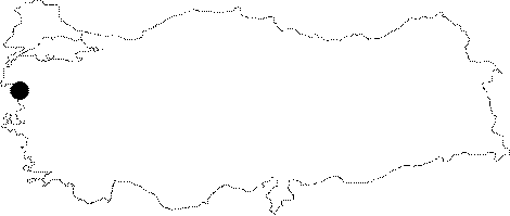 |
For photographs please click on the photo...  |
|
Type:
|
Mound |
|
Altitude:
|
40 m |
|
Region:
|
Aegean |
|
Province:
|
Izmir |
|
District:
|
Dikili |
|
Village:
|
Bahçeli |
|
Investigation Method:
|
Excavation |
|
Period:
|
EBA II |
|
|
|
 |
|
| Location: The mound lies southwest of the city of Balikesir; south of the district of Ayvalik; close to Altinova (to the southwest on Kökten's map); and close to the old Ayvalik-Dikili highway. Today; the highway passes beside the modern settlement. |
| Geography and Environment: The dimensions and the environment of the mound are not specified in the publications. To the northeast flows the Çakal Stream; and to the north a branch of Madra Stream. The region is covered with the fertile soil transported by Madra Stream and this plain is qualified for exposing the transition between the Late Neolithic Age and Early Bronze Age economies. Lambrianides has made a sounding at the skirts of another mound Ñnamely Yeni Yeldegirmeni HöyügüÑ in this region to clarify the formation of the delta. The quite coarse sherds; which with no doubt are prehistoric; found 6 m below plain level indicate the degree of erosion. |
| History: |
| Research and Excavation: It was first discovered by K. Kökten in 1949 and excavated same year in a 2x4 m trench. Excavations in this trench at the northern slope of the mound reached 3.58 m of depth and stopped since architectural remains were recovered at that level [Kökten 1949:816]. K. Lambrianides; who has conducted geomorphological research in 1991 in Altinova Region; reports that he was not able to find the mound and moreover that such a site in this region is not known by the locals. It is concluded that Kaymaktepe may be the hill located southeast of Altinova. |
| Stratigraphy: As reported by K.Kökten; 3 layers were identified at Kaymaktepe. The upper layer of 91 cm thick belongs to the Roman and Ancient Periods. The second layer of ca. 105 cm and the third layer of 45-50 cm thick were dated to EBA by K. Kökten. A fourth layer was mentioned probably dating to the Chalcolithic Age under the EBA levels. |
| Small Finds: Architecture: The third layer yielded a mudbrick wall; 60 cm thick; belonging to the corner of a building. After cleaning the ruins of the walls; a stone paved floor was unearthed. Pottery: No detailed information is provided about the EBA pottery. K. Kökten evaluates the finds in the EBA culture of Western Anatolia. Lambrianides and Spencer claim that the material published by K. Kökten includes pottery similar to the Troy I and Thermi A-B. They indicate that they are comparable with Kumtepe Ia; Ib and Troy I. |
| Remains: |
| Interpretation and Dating: Kaymaktepe is an unidentified settlement because of the lack of detailed information. The excavation records of K. Kökten and the material recovered are lost. Yet; Kaymaktepe is presumably the same site as Höyücektepe. Plenty of EBA pottery was collected from the surface of Höyücektepe; but no finds dating to earlier periods were recovered. |