|
©The Archaeological Settlements of Turkey - TAY Project
|
|
|
|
|
|
Ikinciler / Kazan Höyük |
|
|
For site maps and drawings please click on the picture...  |
For photographs please click on the photo... 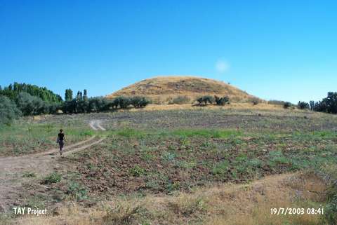 |
|
Type:
|
Mound |
|
Altitude:
|
1040 m |
|
Region:
|
Eastern Anatolia |
|
Province:
|
Malatya |
|
District:
|
Akçadag |
|
Village:
|
Ikinciler |
|
Investigation Method:
|
Survey |
|
Period:
|
|
|
|
|
 |
|
| It lies east of Dogansehir road; 6.5 km south of Akçadag; west-southwest of Malatya. The round mound; measuring 75 m in diameter is located south of Ören Village. It was discovered by C.A. Burney in 1956. In addition to the materials dating from the Chalcolithic Age; sherds of the black burnished Karaz ware and red-brown burnished ware were recovered. It takes place in the registered archaeological sites list prepared by Ministry of Culture and Tourism. |
| Location: |
| Geography and Environment: |
| History: |
| Research and Excavation: |
| Stratigraphy: |
| Small Finds: |
| Remains: |
| Interpretation and Dating: |