|
©The Archaeological Settlements of Turkey - TAY Project
|
|
|
|
|
|
Ishakli / Sultandagi |
|
|
For site maps and drawings please click on the picture... 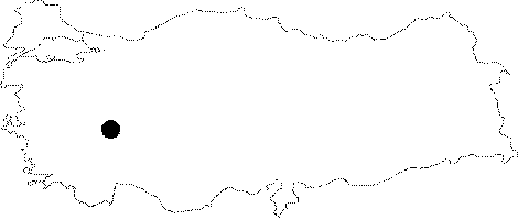 |
For photographs please click on the photo... 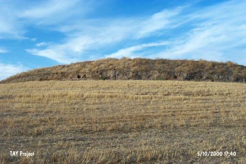 |
|
Type:
|
Mound |
|
Altitude:
|
550 m |
|
Region:
|
Aegean |
|
Province:
|
Afyonkarahisar |
|
District:
|
Sultandag |
|
Village:
|
Merkez |
|
Investigation Method:
|
Survey |
|
Period:
|
Ceramic |
|
|
|
 |
|
| This site lies southeast of the city of Afyonkarahisar; in the northwestern part of the town of Sultandagi; immediately beyond the town border. The site is located approximately 200 m east of the Afyonkarahisar-Aksehir highway. The mound is large; has a 200x100 m diameter and is 8 m high. In many publications; the mound is referred to as Isahli Hissar or Ishalki. The old name of the site was Ishalki Sultandagi. The Sultandagi Plain is bounded by the southern flanks of Mount Emir to the north and by the Sultandaglari Mountains to the southwest. The site; surveyed in 1961 by D.H. French; has attracted many researchers. A red slipped bowl; which can possibly be dated to the Neolithic; was found at the site. This find shows close affinity with the Late Neolithic vessels from Hacilar. |
| Location: |
| Geography and Environment: |
| History: |
| Research and Excavation: |
| Stratigraphy: |
| Small Finds: |
| Remains: |
| Interpretation and Dating: |