|
©The Archaeological Settlements of Turkey - TAY Project
|
|
|
|
|
|
Kayislar |
|
|
For site maps and drawings please click on the picture... 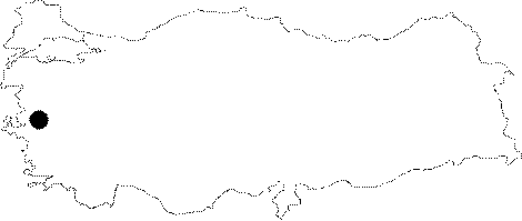 |
For photographs please click on the photo... 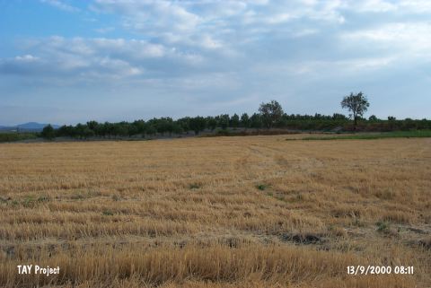 |
|
Type:
|
Mound |
|
Altitude:
|
100 m |
|
Region:
|
Aegean |
|
Province:
|
Manisa |
|
District:
|
Saruhanli |
|
Village:
|
Kayislar |
|
Investigation Method:
|
Survey |
|
Period:
|
Late |
|
|
|
 |
|
| The small; broad and shallow; 80x50 m mound; measuring 3-4 m in height; lies noertheast of Manisa and of Saruhanli district; approximately 900 m north of Kayislar village. It is locally known as Çayirlar Mevkii. A wide stream passes by the west of the mound. A surface collecting was conducted by D.H. French in 1959. A swamp on the west and a road on the east of the mound were observed in this survey. Sherds in black burnished ware resembling Beycesultan and Kumtepe I b; dating to the Chalcolithic Age were collected from the surface. The existence of sherds with Beycesultan Late Chalcolithic Age phases 1-4 characteristics were also reported. (for Neolithic Age at Kayislar see Harmankaya et al. 1997:Kayislar) |
| Location: This site lies northeast of the city of Manisa; northeast of the town of Saruhanli; approximately 400 km northeast of the village of Kayislar. It is possible to get to this site by taking the turnoff to Kayislar from the Manisa-Akhisar highway. |
| Geography and Environment: The small mound; which lies on a low ridge; is oval in shape. It is 80 m long north-south; 50 m long east-west and 3-4 m high. Today the surface of the mound is cultivated. There is a dirt village road on the eastern side of the mound and a spring at the western foot of the mound. In 1965; when the site was surveyed; the area west of the mound was a swamp. |
| History: |
| Research and Excavation: |
| Stratigraphy: |
| Small Finds: |
| Remains: |
| Interpretation and Dating: |