|
©The Archaeological Settlements of Turkey - TAY Project
|
|
|
|
|
|
Kinik |
|
|
For site maps and drawings please click on the picture...  |
For photographs please click on the photo... 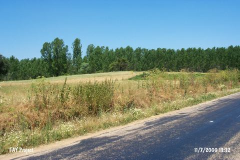 |
|
Type:
|
Mound |
|
Altitude:
|
785 m |
|
Region:
|
Marmara |
|
Province:
|
Bilecik |
|
District:
|
Pazaryeri |
|
Village:
|
Kinik |
|
Investigation Method:
|
Survey |
|
Period:
|
|
|
|
|
 |
|
| It lies on the exit to Kinik Village; 5 km northwest of Pazaryeri District; southwest of Bilecik Province. It was discovered by D.H. French in 1965 and re-investigated by T.Efe afterwards. It measures 150x4 m in dimensions. The surface collection yielded materials dating from Middle Chalcolithic Age; EBA; and a restricted number of material from 2nd millennium BC. |
| Location: The mound is located southwest of the centrum of Bilecik; directly 5 km northwest of Pazaryeri District. It is at the junction of Kinik Village road and the highway; on the right and 300 m from the village. |
| Geography and Environment: It is a broad and shallow mound; 4 m in height and 150 m in diameter. Sorgun Stream flows from the southeast of it. Its surroundings are being cultivated in the present. |
| History: |
| Research and Excavation: |
| Stratigraphy: |
| Small Finds: |
| Remains: |
| Interpretation and Dating: |