|
©The Archaeological Settlements of Turkey - TAY Project
|
|
|
|
|
|
Pascu Höyük |
|
|
For site maps and drawings please click on the picture...  |
For photographs please click on the photo... 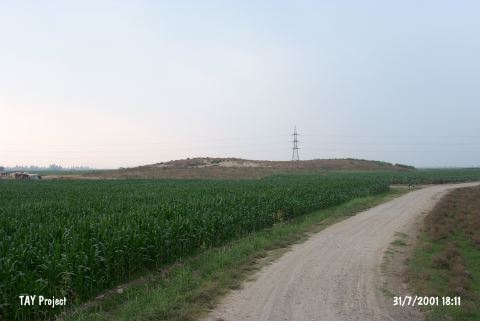 |
|
Type:
|
Mound |
|
Altitude:
|
90 m |
|
Region:
|
Mediterranean |
|
Province:
|
Osmaniye |
|
District:
|
Kadirli |
|
Village:
|
Tatarli |
|
Investigation Method:
|
Survey |
|
Period:
|
Ceramic |
|
|
|
 |
|
| Location: This site lies east of the Ceyhan-Kadirli highway; 6.2 km southwest of Tatarli Village; 20 km northeast of the town of Ceyhan; northeast of the city of Adana. It is locally known as Ikiz Tepe (Twin Hills). |
| Geography and Environment: The site lies along a stream bed of now completely dried stream which used to empty into the Ceyhan River. It is a medium sized mound 10 m in height. |
| History: |
| Research and Excavation: The site was discovered in 1951 by Seton-Williams. It takes place in the registered archaeological sites list prepared by Ministry of Culture and Tourism. |
| Stratigraphy: The ceramics collected from the site were compared with the available seriated pottery and assigned to the Late Neolithic-Early Chalcolithic; Early Bronze Age; Late Bronze Age; Hellenistic and Roman and Islamic Periods. |
| Small Finds: Pottery: Painted and burnished ware similar to Mersin Yumuktepe XXVI-XXIV and assigned to the Neolithic Period was found at the site. Chipped Stone: The surface survey conducted on the mound yielded obsidian and chipped stone finds. The finds include one characteristically Late Neolithic Amuq point. |
| Remains: |
| Interpretation and Dating: In ASPRO; the site has been placed into the fifth phase. The uncalibrated date for this phase is 8;000-7;600 BP [Hours et al. 1994:268]. Todd considers Pascu Höyük a Neolithic site. |