|
©The Archaeological Settlements of Turkey - TAY Project
|
|
|
|
|
|
Sarikavak |
|
|
For site maps and drawings please click on the picture...  |
For photographs please click on the photo... 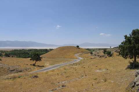 |
|
Type:
|
Mound |
|
Altitude:
|
955 m |
|
Region:
|
Aegean |
|
Province:
|
Afyonkarahisar |
|
District:
|
Dinar |
|
Village:
|
Sarikavak |
|
Investigation Method:
|
Survey |
|
Period:
|
|
|
|
|
 |
|
| It lies about 720 m southeast of the village of Sarikavak; north-northwest of the Lake Acigöl; southwest of Dazkiri and Dinar; about 115 km southwest of Afyonkarahisar Province as the crow flies. It is situated far from the lake. On its west-southwest skirt is a dry river bed. It is indicated as an EBA settlement in the map of the guide of the Afyon Archaeological Museum without providing any further detail. It is suggested to be the ancient city of Sanaus. The mound probably remains east of the Denizli-Afyon highway in the Dazkiri Plain. |
| Location: |
| Geography and Environment: |
| History: |
| Research and Excavation: |
| Stratigraphy: |
| Small Finds: |
| Remains: |
| Interpretation and Dating: |