|
©The Archaeological Settlements of Turkey - TAY Project
|
|
|
|
|
|
Tilkiburnu |
|
|
For site maps and drawings please click on the picture...  |
For photographs please click on the photo... 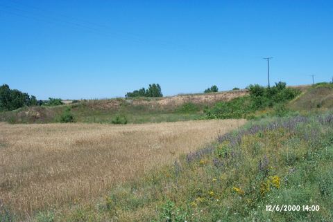 |
|
Type:
|
Mound |
|
Altitude:
|
48 m |
|
Region:
|
Marmara |
|
Province:
|
Kirklareli |
|
District:
|
Babaeski |
|
Village:
|
Nacak |
|
Investigation Method:
|
Excavation |
|
Period:
|
|
|
|
|
 |
|
| The site lies approximately 18 km south of Kirklareli; 1.5 km north of Yeniköy Village; 600-750 m east of Yanciklar or Nacaklar Village. One can get to the mound via Babaeski-Kirklareli highway taking Yeniköy road after 12 km from Babaeski. The settlement is 4.9 km from Yeniköy turning. The road between Yeniköy and Karabayir passes through the northern section of the mound. The site was severely damaged by taking out sand; for producing cement; from the layers below the cultural deposit. Therefore; a large pit with very long sections was formed at the center. The mound; located on the east bank of Seytanderesi; measures 180x130 m due to the distribution of ceramics. The thickness of the cultural deposit is not more than 1 m at the section [Özdogan 1982b:3-4]. Two little creeks from the slopes of Eski Baglik and Kocayer join and empty into Seytanderesi. Soundings were opened by M. Özdogan for leveling the long section of the mound in 1981. Traces of floors and pits are observed in the 1 m thick cultural deposit. Three levels were revealed; the first dating to the Late Chalcolithic Age Ğ Early Bronze Age Transition Period; the second dating to the EBA; and the third dating to the Iron Age. |
| Location: The site lies approximately 18 km south of Kirklareli; 1.5 km north of Yeniköy Village; 600-750 m east of Yanciklar or Nacaklar Village. One can get to the mound via Babaeski-Kirklareli highway taking Yeniköy road after 12 km from Babaeski. The settlement is 4.9 km from Yeniköy turning. The road between Yeniköy and Karabayir passes through northern section of the mound. |
| Geography and Environment: The site was severely damaged by taking out sand; for producing cement; from the layers below the cultural deposit. Therefore; a large pit with very long sections was formed at the center. The mound; located on the east bank of Seytanderesi; measures 180x130 m due to the distribution of ceramics. The thickness of the cultural deposit is not more than 1 m at the section [Özdogan 1982b:3-4]. Two little creeks from the slopes of Eski Baglik and Kocayer join and empty into Seytanderesi. |
| History: |
| Research and Excavation: |
| Stratigraphy: |
| Small Finds: |
| Remains: |
| Interpretation and Dating: |