|
©The Archaeological Settlements of Turkey - TAY Project
|
|
|
|
|
|
Yügücek |
|
|
For site maps and drawings please click on the picture...  |
For photographs please click on the photo... 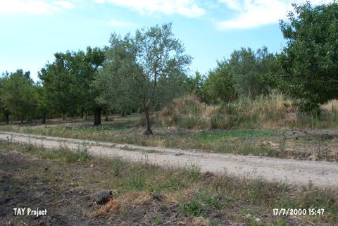 |
|
Type:
|
Mound |
|
Altitude:
|
128 m |
|
Region:
|
Marmara |
|
Province:
|
Bursa |
|
District:
|
Iznik |
|
Village:
|
Merkez |
|
Investigation Method:
|
Survey |
|
Period:
|
|
|
|
|
 |
|
| It is 1 km far from the lake; on the western side of the Iznik-Yenisehir motorway; about 1 km south of Iznik District; northeast of Bursa Province. It measures 3 m in height and 100 m in diameter. It was discovered by K. Kökten in 1948; and re-visited by J. Mellaart in 1960 and D.H. French in 1965 for surface collection. According to D.H. French; sherds of the handmade; black burnished and black rimmed Yenisehir ware were recovered. To prevent any confusion with other Yügücek; it is called Iznik Yügücek. It takes place in the registered archaeological sites list prepared by Ministry of Culture and Tourism. |
| Location: This site is northeast of the city of Bursa; 1 km south of the town of Iznik; west of the Iznik-Yenisehir highway. |
| Geography and Environment: The mound; which is 3 m high and has a 100 m diameter; is 1 km from the Iznik Lake in the fertile Iznik Plain. |
| History: |
| Research and Excavation: |
| Stratigraphy: |
| Small Finds: |
| Remains: |
| Interpretation and Dating: |