|
©The Archaeological Settlements of Turkey - TAY Project
|
|
|
|
|
|
Dökmetepe |
|
|
For site maps and drawings please click on the picture...  |
For photographs please click on the photo... 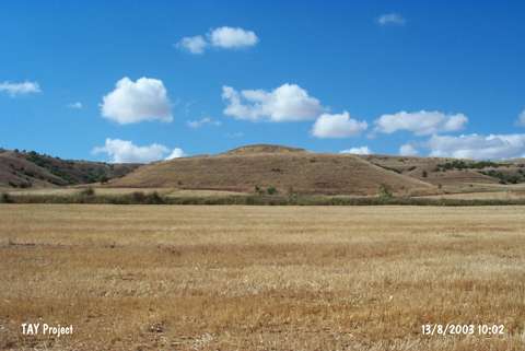 |
|
Type:
|
Upland Settlement |
|
Altitude:
|
840 m |
|
Region:
|
Black Sea |
|
Province:
|
Tokat |
|
District:
|
Zile |
|
Village:
|
Üçköy |
|
Investigation Method:
|
Survey |
|
Period:
|
|
|
|
|
 |
|
| It is located immediately north of Himmet Abdat Tepesi and 2.4 km southwest of the village of Üçköy; 18 km southwest of the Zile district of the Tokat province. The settlement is also known as Hanyeri Mevkii and lies on a hill measuring 150 m in diameter and 12 m in height. Late Chalcolithic; EBA; 2nd millennium BC and Iron Age material was encountered. It was observed that the mound; rising like a monument in the middle of the fertile plain; was densely destructed and that the destruction is continuous. |
| Location: |
| Geography and Environment: |
| History: |
| Research and Excavation: |
| Stratigraphy: |
| Small Finds: |
| Remains: |
| Interpretation and Dating: |