|
©The Archaeological Settlements of Turkey - TAY Project
|
|
|
|
|
|
No Name (Eregli / Aziziye) |
|
|
For site maps and drawings please click on the picture...  |
For photographs please click on the photo... 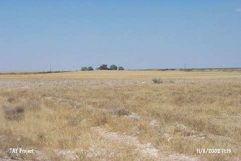 |
|
Type:
|
Mound |
|
Altitude:
|
1150 m |
|
Region:
|
Central Anatolia |
|
Province:
|
Konya |
|
District:
|
Eregli |
|
Village:
|
Aziziye |
|
Investigation Method:
|
Survey |
|
Period:
|
|
|
|
|
 |
|
| The mound lies within the vicinity of Aziziye Village; northeast of Eregli District of Konya Province. It is located immediately northwest of Ankara-Adana motorway and 2 km north of Konya junction on this road. The shallow mound is surrounded by planted fields The site of Çayhan/Çakmak is located 300 m west of the mound. It was observed and documented during TAYEx 2002 Central Anatolia region [TAYEx 11.8.2002]. |
| Location: |
| Geography and Environment: |
| History: |
| Research and Excavation: |
| Stratigraphy: |
| Small Finds: |
| Remains: |
| Interpretation and Dating: |