|
©The Archaeological Settlements of Turkey - TAY Project
|
|
|
|
|
|
Beycesultan |
|
|
For site maps and drawings please click on the picture...  |
For photographs please click on the photo... 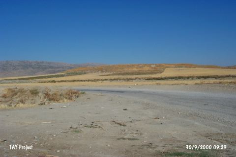 |
|
Type:
|
Mound |
|
Altitude:
|
750 m |
|
Region:
|
Aegean |
|
Province:
|
Denizli |
|
District:
|
Çivril |
|
Village:
|
Kocayaka |
|
Investigation Method:
|
Excavation |
|
Period:
|
EBA I EBA II EBA III |
|
|
|
 |
|
| Location: It lies next to the village of Mentese; 5 km southwest of the Çivril District; northeast of the Denizli Province. It is one of the biggest mounds in the vicinity of Denizli. It reads Behicesultan on the 1:200.000 map due to the tomb of an Ottoman saint located on the top hill. |
| Geography and Environment: An old channel of the Menderes River (Meandros) can be seen on the east of the settlement founded in the valley of Çivril. Possibly the river used to flow through this channel during that era. The mound has two hills; east and west. The path to the village of Yakacik passes through these two mounds [Lloyd-Mellaart 1962:plan in fig.1]. The western hill is 25 m while the eastern is 24 m high. The area between the two hills is 18 m high from the plain. The cone is 700x500 m. Depending on the distribution of sherds; the settlement's diameter is reported to measure 1 km. |
| History: |
| Research and Excavation: The mound was discovered by J. Mellaart; and excavated by S. Lloyd and J. Mellaart in 1954-59; revealing important information; especially about the Bronze Ages; for the Aegean Archaeology. The trench; "sx"; exposed the stratigraphy of Beycesultan. Chalcolithic Age levels were found at an area of 3x3.5 m. Virgin soil was reached at 2 m below surface. This shows that the plain was not filled with too much alluvium and the first settlers inhabited a natural elevation. It takes place in the registered archaeological sites list prepared by Ministry of Culture and Tourism. After 48 years, the excavations were restarted under the directorship of Esref Abay on the date of 6th August 2007. |
| Stratigraphy: The excavators identified 40 levels in the SX trench on the west; each represented by roman numerals. The western hill was flattened and a fortress was built during the Byzantine Period. The eastern hill was used as a cemetery during the Ottoman Period. The virgin soil was reached 2 m below the today's floor. The EBA levels included in our study were identified as levels XIX-VI (19-6) out of 40. Levels XL-XX was identified as Chalcolithic Age; V-IV as MBA and III-I as LBA. The EBA levels have been attested only in a very limited area. Their sub-phases are as follows; XIX-XVII: EBA I XVI-XIII: EBA II XII-VIII: EBA IIIa VII-VI: EBA IIIb The stratigraphy of Beycesultan of Second Period excavations as follows: 1a, 1b, 1c: Seljuk- The period of Beylik's 2a2, 2a1, 2b: Byzantine Period 3: Iron Age 4a, 4b: Late Bronze Age 5a1-a3, 5b: Late Bronze Age |
| Small Finds: Architecture (in ascending order):The 125 cm thick wall foundation uncovered at the level XIX of EBA I may belong to a fortification or a big building. The level XVII; on the other hand; yielded a building with a complete plan. It consists of a front room with an anta and two rooms built back to back in the north-south direction (megaron). According to the excavators; it is a pioneering structure of the EBA II temples [Lloyd-Mellaart 1962:fig.9]. There is a bench and a mudbrick silo/coffer and ruins of probably an altar in the middle in the first room. The back room probably belongs to the priest in charge. The mudbrick walls on both sides show that it is a multi roomed building. The child graves support that it is a religious place. Considering that the EBA II temples were built in the same area and direction; that comment may not be wrong. The levels XVI-XIV of EBA II yielded temples at the same location on top of each other; again in the same trench SX [Lloyd-Mellaart 1962:fig.8]. The common characteristics of those buildings are that they have quadrangular rooms; domed kilns; hearths; benches; and storages. Their mudbrick walls on stone foundations were neatly plastered. Out of many rooms; the one in the middle was used as temple. Sometimes; two temples were built next to each other. The front room of the buildings interconnects with a sacred room including the altar. Behind that; there is another room the priest resided and stored the gifts. The temple is separated into two by mats hanged on wooden poles. The temple in level XV is different than others with its distinctive altar. Two clay plates stand in the middle of the western temple room; separated by a pit. In front of those plates; there are two clay horns-like projections; and behind them quadrangular vessel holders [Lloyd- Mellaart 1962:plan in fig.13]. The tree in front of the altar represents a wooden post cult. J. Mellaart explains that during the ritual the priest probably stood behind the plates; and in the front of the plates people put their votives into the vessels in the back by passing them through the projected horns. There is a similar altar in the western temple. No traces of fire were found in front of the altars. In the back of the western temple; the door of the priest's room is observed; however in the eastern temple the door is possibly under the area which is not excavated yet. The room in the far west has the characteristics of a living room with the hearth in the middle and clay closets in the corners of the entrance wall. The excavated area is too small; and the relationship of this architecture to the rest of the buildings in the city could not be determined. That is why the comments on the temples of Beycesultan are insufficient. Do those buildings belong to a palace or to the buildings with a courtyard in between? It is impossible to answer those questions. It is also unknown if the double-temple buildings were sacred places for different gods. The level XIV yielded a totally different plan [Lloyd-Mellaart 1962:plan in fig.17]. In that level; there are two temples consisting of small rooms with access to each other. The building extends toward the southwest like a complex. There are no passages to prove any relationship between the temples. The EBA III buildings were only revealed in the S and SX trenches. The buildings of those levels are more orderly. Again the walls are of mudbrick on a stone foundation. They were fortified with wooden beams. Levels XII-XI yielded only scanty architectural remains. Megaron-like buildings were uncovered at levels X-VIII. Excavators suggest that the city consisted of megara built side by side during that era. In 5x10 m rectangular megara; the entrance is through the front courtyard on the west. Inside the so called building A; there is a hearth and oven in the middle; sitting benches in the corners. Absence of any finds in the building might be related with the fact that it was built for specific social events like ceremonies. In the building B there is a circular hearth in the middle. In 2012, the plan square L27 belonging to Level 8 (EBA) yielded pottery sherds and a stone foundation dated to EBA III. This stone foundation is with a thickness of 40 cm and it extends in the southwest-northeast direction [Abay-Dedeoglu 2014:390]. Ceramics: The pottery industry of Beycesultan dating from the EBA I includes improved versions of most of the typical samples from the Chalcolithic Age. There are two groups of ware according to the excavators; fine and coarse ware. The fine ware is tempered with grit and straw. Surface colors are black; blue-black; grey; pink; orange-red; orange; buff; brown and red-brown. All are neatly burnished and polished. The color variations decrease as levels go higher; and black and red colors become dominant. The bowls are decorated with horizontal and vertical excisions. The white paint decoration of the Late Chalcolithic Age continues. Very limited number of vessels bears incision decorations with fillings. Bowls; dishes; single handled cups; pitchers; jugs; double handled vessels and composite vessels are usual forms [Lloyd-Mellaart 1962:plate # 3]. Vessels with elevated rims which are the former type of spouted vessels are defined as types 9 and 16. The design plate given by the excavators illustrates a rich variety of vessel forms including drawings of 28 vessel types. Some are identified as votive vessels. The coarse ware is in variations of brown and red. Probably the kitchen ware is of that type. During EBA II the coarse kitchen ware disappears. Except for one; all are hand-made. Thick and broken-like wash was applied on the surface of the vessel in various colors. The levels of this phase do not have a common color. There are variations of red; black; buff; grey and brown. Decorations were applied by excisions; knobs and reliefs. Some vessels are painted in red with a cross motif. White paint decorations continue with beautiful examples. Compared to other phases of EBA; the industry is very rich in forms. Flat bowls; pitchers; mugs; jugs; vases; pithoi and footed vessels are usual forms [Lloyd-Mellaart 1962:add. pl.4-5]. Horn-like handles above the rim; twisted handles are interesting. After analyzing the pottery of EBA III; it can be suggested that the first usage of wheel for turning ceramics was started in that phase. This phase is divided into two sub-phases; IIIa and IIIb. Although fine; they are not as elaborate as the EBA II ware. The red and brown mottled washed ware is tempered with grit and straw. White paint and filling decorations are rare. Some are decorated with mat red paint. Forms are not different than previous phases. Local samples are available; e.g. long and fat; single vertical handled vessel [Lloyd-Mellaart 1962:type 12 at add.pl 6]. Flat and deep bowls; cups with double loop handles; fat depas (?); basket handled lids are interesting forms. Same type of ware exists in the levels VII and VI of EBA IIIb. Wheel-made production is more common. The number of red-cross decorated bowls increases. Surface colours are black; gray; orange; buff; pink and red. Spouted jug (type 15); footed and handled vessel (type 19a) are common types of this phase. There are vessels similar to the ones of MBA. Some scientists date those last levels as the transition levels from EBA to MBA depending on the vessel types [Korfmann 1989:chronological table in fig.3]. Clay: Terra cotta idols and figurines are similar to the ones found in the other EBA centers of Anatolia. Spindle-whorls were produced and decorated elaborately. Their forms can be defined as high double cones. They are decorated with incised crosses; folds and stars with white fillings. Some are so small that they can not be used as spindle-whorls. Some flat types were recovered from EBA II. In EBA III; decorations were applied only on one side. The smallest samples of those were presumably used as beads. Ground stone: Starting from the lowest phase; many schematized idols in marble were revealed because temples were very often encountered during the excavations. In EBA I; the flat violin shaped marble idols have pointed heads; bag-shaped bodies and projected arms [Lloyd-Mellaart 1962:fig.F1/1-14]. One of them was carved as a round head (disc-head). This type of idol is also seen at EBA II with a round head; neck; small projected arms and round body [Lloyd-Mellaart 1962:fig.F.1/15-21]. In EBA III; only a broken fragment of an idol was recovered. On the other hand; there are shaft-holed axe/hammers at this phase. The presence of decoration can be seen in beads and amulets. Among the samples of sealing craft; only one stone seal bears a geometrical decoration. Metal: The EBA II levels yielded many copper daggers [Stronach 1962:fig.F.9/1-5]. Some are too small. They might have been used as pocket-knives. Similar examples of those daggers with triangular and crooked tang are also seen in the contemporary settlements in Anatolia. The level XIII of EBA II yielded a small razorblade [Stronach 1962:fig.F.9/6]. The presence of a winged hammer mold made of stone in the level IX of EBA III indicates that the transition to MBA cultures starts from this level. Pin forms include double conic headed; half spherical; needle with a scroll eye and fibulas [Stronach 1962:fig.F.11]. The scroll eye of the needle was formed by bending the blunt head. In EBA III; pins; flat chisels and axes were found. Human Remains: The number of graves at Beycesultan is very poor. Probably they had an extramural cemetery. Limited numbers of child graves were brought to light. Big pithoi were used as child graves. No survey was carried out to find out the extramural cemetery. |
| Remains: |
| Interpretation and Dating: The research on Beycesultan does not only consist of the excavation itself but it goes on with the exploration of the Aegean and West Central Anatolian settlements' surface finds according to the levels of Beycesultan. This helps us reach a thorough understanding of the cultural heritage of the area. The insufficiency of the archaeological knowledge in the sixties and the lack of 14C dating system have misled the excavators in determining the exact dates. According to the excavators; the dates depending on the levels and the EBA phases are as follows: EBA I id dated to 3500-3400 BC; however these dates are even older than the given dates for Troy I. For EBA II; a range of 2900-2300 BC was suggested. Although it was claimed to be contemporary with Troy II; Karatas Semayük; Kusura B and Yortan; this comment is no longer valid. EBA III is dated to 2300-1900 BC. J. Mellaart has the tendency to relate the cultural change (Please see architectural finds) to the Luwian people who came to the area upon a conquest. Depending on the similarities in pottery; it is comparable with Troy III-V levels [Lloyd-Mellaart 1962:241]. In his article on the chronology of Anatolia; M.J. Mellink does not agree with the excavators on the dating of the stratifications. He relates the levels XIX-XVII to EBA II; XVI-XIII to EBA IIIa; XII-VI to EBA IIIb on the basis of the Gözlükule stratification [Mellink 1965:table on page 126]. In harmony with the stratification of S. Lloyd and J. Mellaart; M. Korfmann; on the other side; who lately started conducting the Troy excavation states that there is only a gap at the beginning of EBA III. The researcher identifies the levels XIX-XVII as EBA I; XVI-XIV as EBA IIa; XIII as EBA IIIb. He claims there is no settlement on the mound between the levels XIII and XII and evaluates the levels XII-XI as EBA IIIa; X-VIII as IIIb and VII-VI as transition from EBA to MBA [Korfmann 1989:chronological table in fig.3]. As observed; there are different views on the Anatolian prehistoric cultural chronology for the stratification of Beycesultan levels. With its 25 m high cultural deposit; Beycesultan houses significant settlement remains of the vicinity. Its significance increases considering the fact that it lies in the triangle of Central Anatolia formed by Mediterranean; Aegean and Northwest Anatolian regions. The validity or dependability of the comments becomes null considering that the excavations were carried out only in a limited area; particularly on the slope of the western hill for a very limited period of 6 years. The exposure of so many temples in such a limited area is very surprising. Lack of any similar cases for other contemporary settlements leaves the problem unsolved. On the other hand; Beycesultan was helpful for the dating of some; if not all; surface finds recovered from the vicinity. If the stratification and dating of Beycesultan is incorrect; other settlements in the area could have been misdated and misstratified either. Beycesultan is a site which can provide essential information for the area in general. Therefore; the excavation must have been continued. |