|
©The Archaeological Settlements of Turkey - TAY Project
|
|
|
|
|
|
Asagi Anzaf Kalesi |
|
|
For site maps and drawings please click on the picture... 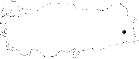 |
For photographs please click on the photo...  |
|
Type:
|
Fortress |
|
Altitude:
|
m |
|
Region:
|
Eastern Anatolia |
|
Province:
|
Van |
|
District:
|
Özalp |
|
Village:
|
Dereüstü |
|
Investigation Method:
|
Excavation |
|
Period:
|
|
|
|
|
 |
|
| Location: Lower Anzaf Fortress lies 11 km northeast of the Urartian capital, Tushpa, close to the modern motorway and railway between Van and Iran. |
| Geography and Environment: It was founded on a calcerous and slightly bumpy rock, 1900 m high above the sea level. Strecthing in the north-south direction, the fortress measures 62x98 m in dimensions with a rectangular plan. It was founded on an area covering approximately 6000 square meters. Having a very significant defensive role during the ancient periods, the Lower Anzaf Fortress was located at the last crucial point of the historic roads, which ran from northwest Iran to the east, and from Transcaucasia to the north, heading toward Tushpa, the capital of the Urartu Kingdom. It was founded on the narrowest section of the Erçek-Özalp-Saray Plain, which now starts from the Turkish-Iranian border, getting narrower towards the Lake Van to the west. It is almost impossible to find alike of Lower Anzaf Fortress in the Van region. The fortress served as an outpost which provided protection for both the Upper Anzaf Fortress and the Urartian capital, Tushpa and Rusahinili (Toprakkale) against any potential attacks. The most important feature of the Lower Anzaf Fortress, which distinguishes it from its contemporaries, Kalecik to the north the Van Plain Aşağı, and Zivistan to the south of the same plain is the presence of curtain wall and bastions, which facilitated defence and also helped to support the weight of the super structures. |
| History: |
| Research and Excavation: The excavations of Lower Anzaf Fortress that were initiated in 1991 under the direction of Oktay Belli have been continued by Oktay Belli and Alpaslan Ceylan. |
| Stratigraphy: The excavations conducted in the Lower Anzaf Fortress yielded two building levels. The lower level is from the Iron Age while the upper one is from the Middle Age. In addition to fragments of stoneware belonging to the Iron Age, fragments of glazed, green, and yellow stoneware belonging to the Middle Age were found. The medieval inhabitants of Anzaf disturbed architectural remains from the Iron Age. |
| Small Finds: Architectural Material: It was built by Urartian King Ishpuini in 830-810 BC. A terrace wall which connects the eastern and western fortifications like a spine, 24 m south of the northern wall, with an elaborate masonry is very interesting. To the north of the terrace wall which has an average height of 50 cm is an unoccupied area covering 1300 square meters, the floor being coated elaborately with large mud-brick blocks. It seems that this rectangular area was used as an inner courtyard communicated with the large buildings opening to the terrace to the north. When military purpose of the Lower Anzaf Fortress is considered, it becomes clear that theis open area enclosed by high fortifications was used used as an inner courtyard by the military garrison. Almost all of the large Urartian buildings, which opened to the terrace to the north, were unfortunately damaged heavily during reoccupation by the medieval inhabitants. It witnessed a very big Middle Age settlement. This heavy damage prevented us from bringing the plan and purpose of the Urartian buildings to light. The maingate pierces the southern wall. It was built on the most appropriate point for defence purposes. Unfortunately, the fortification walls of the fortress were cruelly demolished by bulldozers of the Regional Directorate for Highways in Van 1in 1980 during the construction of the modern Van-Özalp-Saray-Iran motorway. The Lower Anzaf Fortress suffered a grave damage as a result of this demolishment. However, even the present appearance of the gate represents the earliest specimen of the Urartian citadel gates. Very durable walls of the gate room measure 2.40 m in width in average with a height of 1 m above the floor. Also, it is beielved that it was a double winged gate, measuring 5 m in width. The nearest example of this gate is found at the East Gate of Yukari Kale, which allows access to the sancatuary area of the god Haldi in Cavustepe. Pottery: Excavations yielded many sherds from the Urartu Period. Among them are trefoil-jugs, bowls, pots, small vessels, lamps, deep bowls, red slipped, polished, glazed well-fired ware. Also found are sherds from the Middle Age. Skeleton of a dog and a man were found during the excavations along with a couple of golden earrings adjacent to them. |
| Remains: |
| Interpretation and Dating: The Lower Anzaf Fortress was built for military purposes with a strategically very significant position. It was a significant outpost which protected the Urartian capital Tushpa and Toprakkale (Rusahinili). It was inhabited during the Urartu Period, but heavily disturbed during the reoccupation in the Middle Age. |