|
©The Archaeological Settlements of Turkey - TAY Project
|
|
|
|
|
|
Tatar Höyük |
|
|
For site maps and drawings please click on the picture...  |
For photographs please click on the photo... 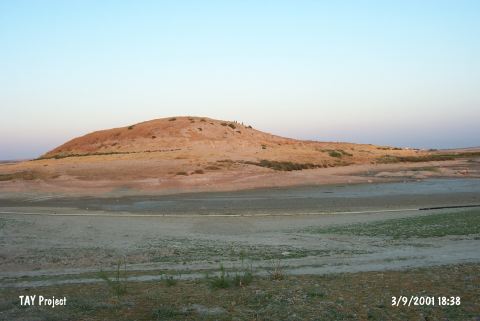 |
|
Type:
|
Mound |
|
Altitude:
|
560 m |
|
Region:
|
Southeastern Anatolia |
|
Province:
|
Sanliurfa |
|
District:
|
Bozova |
|
Village:
|
Tatarhüyük |
|
Investigation Method:
|
Excavation |
|
Period:
|
|
|
|
|
 |
|
| It lies 18 km up from Saskan Küçüktepe above the Incesu Stream, 10 km southwest of Titris Höyük, 9 km northeast of Bozova. It was investigated under the direction of Ü. Serdaroglu and M. Özdogan during the Lower Euphrates Survey in 1975 and 1977, respectively. The section so called Lower Area covers an area of 14.5 acres and 500x200 m. The mound itself measures 150x11x24 m in dimensions and 4.32 in acres [Wilkinson 1990:181]. It has been heavily destroyed, and it was excavated for a short period under the direction of Ü. Serdaroglu in 1979. It was visited by the Kurban Höyük excavation team between 1982-84; A. Misir of the Urfa Museum and H. Hauptmann conducted a very short excavation on the mound. The following periods were identified: - Chalcolithic Age - Middle-Late Bronze Age - Middle Bronze Age - possibly 2nd Millennium BC and early 1st Millennium BC - Hellenistic Period - Late Roman Period - Early Byzantine Period and Medieval Age [Wilkinson 1990:181]. It takes place in the registered archaeological sites list prepared by Ministry of Culture and Tourism. |
| Location: |
| Geography and Environment: |
| History: |
| Research and Excavation: |
| Stratigraphy: |
| Small Finds: |
| Remains: |
| Interpretation and Dating: |