|
©The Archaeological Settlements of Turkey - TAY Project
|
|
|
|
|
|
Latmos |
|
|
For site maps and drawings please click on the picture... 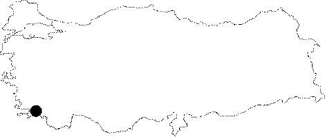 |
For photographs please click on the photo...  |
|
Type:
|
City |
|
Altitude:
|
m |
|
Region:
|
Aegean |
|
Province:
|
Mugla |
|
District:
|
Milas |
|
Village:
|
Kapikiri |
|
Investigation Method:
|
Survey |
|
Period:
|
Archaic Classical |
|
|
|
 |
|
| Location: It is located close to 3 fortresses; 1 km east of Heracleia under Latmos at Kapikiri; to the northwest of the Milas District of the Mugla Province [Peschlow 1976:40]. |
| Geography and Environment: |
| History: Based on the information from the inscriptions; the city which had been inhabited until the 6th and 5th centuries BC; paid 1 talent as a tribute to the Delian League. It was conquered by Mausolus; the Satrap of Caria. According to Bean; the wall surrounding the city was built by Mausolus [Bean 2001:234; McNicoll 1997:75-76]. The city had been abandoned during the 4th century BC; and a new city was constructed to the west on the sea shore (see Heracleia under Latmos). Latmos was used as the necropolis area of the newly founded city. It seems to have been re-inhabited again during the Byzantine Period [Peschlow 1976: 40-41]. |
| Research and Excavation: Latmos was discovered by Pococke in 1740; and investigated in detail by Wiegand in 1905. Krischen and Philippson conducted research in the first half of the 20th century. The researches; which were conducted on behalf of the German Research Association between 1976 and 79 have been still continued under the leadership of Peschlow on behalf of the German Archaeological Institute from 1984 to date. It takes place in the registered archaeological sites list prepared by Ministry of Culture and Tourism. |
| Stratigraphy: |
| Small Finds: |
| Remains: It is uncertain when the city was founded. It preserved the characteristics of a Carian settlement [Peschlow 1986:155-162]. As a small city; it is situated on a land actually not very suitable for settlement. The city wall has been partly preserved. During the construction of the buildings; the available local rocks were used [Peschlow 1986:156]. In addition to remains of streets and houses; there is a well preserved terrace wall; and a large stairway. The potsherds dating to the 6th and 5th centuries show that Latmos was built before Heracleia. The evidence for the ancient city of Latmos is based on the ancient resources and inscriptions uncovered [Peschlow 1976:40-41]. It is believed to have been abandoned latest at the end of the 4th century BC [Peschlow 1978a:21-22]. The section where the public buildings are located is apparently the northwest of the city; based on the systematic plan and the size of the buildings. The Residences from the Late Period; and the two churches at the center indicate that the city had been reinhabited during the Byzantine Period [Bean 2001:238]. City Wall: The highest point of the wall; which can be traced throughout its length; is approximately 4 m. It is pierced by 13 rectangular towers. There are two more towers; one in the north; and one in the west. A small fortress; and a watchtower or signaling tower is located to the north. Although the masonry technique is earlier than of Heracleia; the city wall is dated to the 4th century BC [Peschlow 1977:40]. It is reminiscent of the buildings in Labraunda in terms of masonry [Bean 2001:238]. Temple/Sanctuary: There are two cult areas; one to the northeast; and another to the southwest [Peschlow 1977:40]. Residences: The houses were built in an organized plan. No traces of streets were found. The houses were built using the bedrock. No typical Hellenistic peristyle houses were attested [Peschlow 1978a:21]. Local gneiss was used for walls. Out of the 120 residences; 14 are in good condition. Due to the lack of information on the houses before the Hellenistic Period in Anatolia; these specimens are extremely important. Four of those residences have a single room each; other three have more than one room. Seven buildings are complex structures including more than one house. Single-room houses were founded on a 20 to 40 square meters land. One of them is situated in the crack to the east of the city. It covers an area of 25 square meters; with a square plan. The west wall consists of the rock. Traces of a gabled roof and mezzanine are observed. Probably it was built only for a single family. The multiple room and complex houses are large; and their dimensions vary between 70-110 square meters. They have courtyards are in front; and the rooms are either rectangular or square. They are one story buildings with gabled roofs. They have mezzanines. It is obvious that particular attention was paid to keep them out sight. It seems that the Latmos people preferred to be concealed by the rocks rather than easy access to their houses. No precise dating is possible. The insufficiency of potsherds as well as the presence of very primitive houses may indicate the Archaic or Pre-Archaic Periods. As some of the houses have better masonry; they may have been dated from the 4th century BC. The specimens here have nothing to do with the houses in Priene. The researcher believes that the settlement in Latmos had been inhabited by Lelegs and Cars; and the Latmos houses are of Carian type [Peschlow; 1986:155-162]. Necropolis/Graves: There are Carian type of graves; sarcophagi; and rock grave chambers located in the residential area. One of the grave chambers is located at the center of the city; and the others are located near the southern gate of the city. The sub-structure is made of cut stone blocks; while the upper structure is of marble. Their shape looks like Doric temples with an in antis plan. They are dated to the Hellenistic Period [Peschlow 1976:40-41]. Miscellaneous: Presumably there was a shelter in the Lake of Bafa; and the other structure at Latmos was for watching purposes [Peschlow 1980:216]. |
| Interpretation and Dating: |