|
©The Archaeological Settlements of Turkey - TAY Project
|
|
|
|
|
|
Dineksaray |
|
|
For site maps and drawings please click on the picture...  |
For photographs please click on the photo... 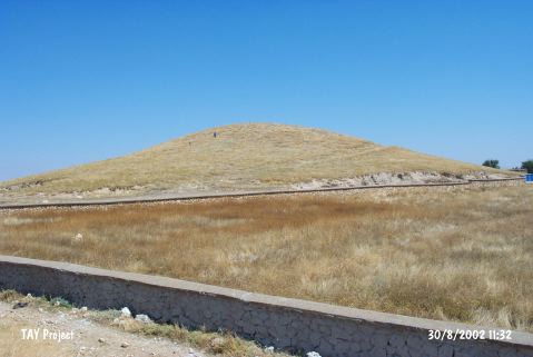 |
|
Type:
|
Mound |
|
Altitude:
|
1040 m |
|
Region:
|
Central Anatolia |
|
Province:
|
Karaman |
|
District:
|
Merkez |
|
Village:
|
Dinek |
|
Investigation Method:
|
Survey |
|
Period:
|
|
|
|
|
 |
|
| It is located between Kilbasan town and Dinek village of Konya. It lies southwest of the modern village; at the 39th km of the Konya-Bozkir motorway. It was discovered by J. Mellaart and later visited by H. Bahar. EBA and Antiquity material was found on the mount that lies between the ancient cities of Isaura and Lykaonia; on the bank of Çarsamba River where the Taurus mountains meet the Konya plain. It is also an important settlement for the 2nd millennium BC. |
| Location: |
| Geography and Environment: |
| History: |
| Research and Excavation: |
| Stratigraphy: |
| Small Finds: |
| Remains: |
| Interpretation and Dating: |