|
©The Archaeological Settlements of Turkey - TAY Project
|
|
|
|
|
|
Alayhan Höyük |
|
|
For site maps and drawings please click on the picture...  |
For photographs please click on the photo... 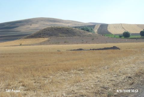 |
|
Type:
|
Mound |
|
Altitude:
|
1205 m |
|
Region:
|
Central Anatolia |
|
Province:
|
Aksaray |
|
District:
|
Merkez |
|
Village:
|
Alayhani |
|
Investigation Method:
|
Survey |
|
Period:
|
|
|
|
|
 |
|
| It lies on the Aksaray-Nevsehir motorway within the borders of the Alayhani Village of the Merkez District in Aksaray. The mound lies to the west of the village, measuring 60 m in diameter, and approximately 25-30 m in height. It is surrounded by a water channel and meadow to the west, and arable fields in other directions. It was discovered during the Survey in the Nevsehir, Nigde and Aksaray Provinces conducted under the direction of H. Sever in 1990. Sherds from the First Bronze Age, Phrygian and Seljuk Periods were collected. |
| Location: |
| Geography and Environment: |
| History: |
| Research and Excavation: |
| Stratigraphy: |
| Small Finds: |
| Remains: |
| Interpretation and Dating: |