|
©The Archaeological Settlements of Turkey - TAY Project
|
|
|
|
|
|
Arslanlar |
|
|
For site maps and drawings please click on the picture...  |
For photographs please click on the photo... 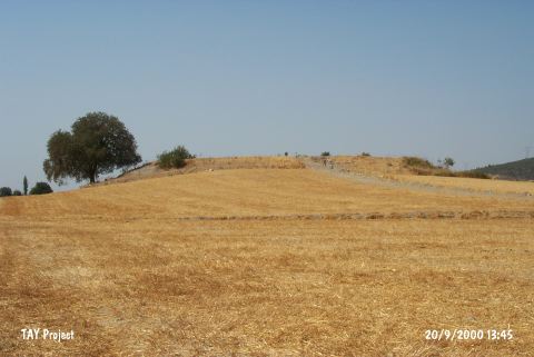 |
|
Type:
|
Mound |
|
Altitude:
|
45 m |
|
Region:
|
Aegean |
|
Province:
|
Izmir |
|
District:
|
Torbali |
|
Village:
|
Arslanlar |
|
Investigation Method:
|
Survey |
|
Period:
|
|
|
|
|
 |
|
| It expands to an area of 8.6 acres in the Torbali District of Izmir. A 5-6 m thick cultural deposit was observed. At the summit of the mound lies a flat ground of 70x50 m which yielded only ceramics from the Roman Period and Middle Age while material which prove that the settlement had been inhabited starting from the First Chalcolithic, continously throughout the Bronze and Iron Ages were collected from the skirts [Tuna 1988:305]. It takes place in the registered archaeological sites list prepared by Ministry of Culture and Tourism. |
| Location: |
| Geography and Environment: |
| History: |
| Research and Excavation: |
| Stratigraphy: |
| Small Finds: |
| Remains: |
| Interpretation and Dating: |