|
©The Archaeological Settlements of Turkey - TAY Project
|
|
|
|
|
|
Büyüktepe |
|
|
For site maps and drawings please click on the picture...  |
For photographs please click on the photo... 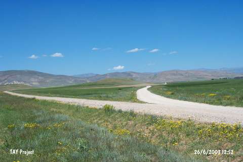 |
|
Type:
|
Mound |
|
Altitude:
|
1770 m |
|
Region:
|
Black Sea |
|
Province:
|
Bayburt |
|
District:
|
Demirözü |
|
Village:
|
Çiftetas |
|
Investigation Method:
|
Excavation |
|
Period:
|
|
|
|
|
 |
|
| It lies to the north of the Çiftetas Village, northeast of the Demirözü District in Bayburt. It is the most significant mound in the region. Based on the data from surveys and excavations conducted by A. Sagona in the mound since 1990, it appears that the societies inhabited on the hill had a nomadic life style. One of the Iron Age finds is represented by the stone foundations of a large-size building roughly in the form of a circle unearthed on the western section of the excavation area. In addition to the finds from the Iron Age, material from the Hellenistic Period were also found, which indicates the presence of a Hellenistic Culture at Bayburt during the Iron Age. Pottery dating to the Late Hellenistic and Early Roman Periods are dried or fired vessels with good character. |
| Location: It is situated 1 km north of the Çiftetas Village; 35 km southwest of the Bayburt Province. It can be reached through a pathway to the village of Çayiryolu; north of the Çiftetas Village. The path lies on the east of the mound [Sagona 1992:fig.1]. The mound is 6 km far from the Çayiryolu Village. |
| Geography and Environment: Büyüktepe consists of two natural hills located in the valley of Bespinar which has very rich water resources. The two hills have a saddle-like connection in between. The one on the south is bigger; 20 m high from the valley and 25x180 m in dimensions. The erosion probably swept the cultural deposit accumulated on the hills; even tough not that thick; for thousands of years and caused the bedrock surfacing in some places [Sagona 1992:305]. |
| History: |
| Research and Excavation: |
| Stratigraphy: |
| Small Finds: |
| Remains: |
| Interpretation and Dating: |